
The GEODE Lab in the Ecological Informatics program at Northern Arizona University (Flagstaff) is seeking a Postdoctoral Researcher to work on a range of projects. We seek someone with strong technical skills to make extensive use of remote sensing image and lidar data in a high performance computing environment, advancing projects focused on mapping, monitoring and modeling broad scale ecosystem changes, incorporating climate, land use and disturbance. A PhD degree in a relevant discipline is required. Additional information and details can be found here.
Climate change is warming Canada’s great expanse of boreal forest, bringing greater risk of fire and disease
GEODE assistant research professor Logan Berner speaks to the CBC about changes underfoot in the boreal forest:
“There is emerging evidence that as the climate continues to warm, the boreal might shift northward”
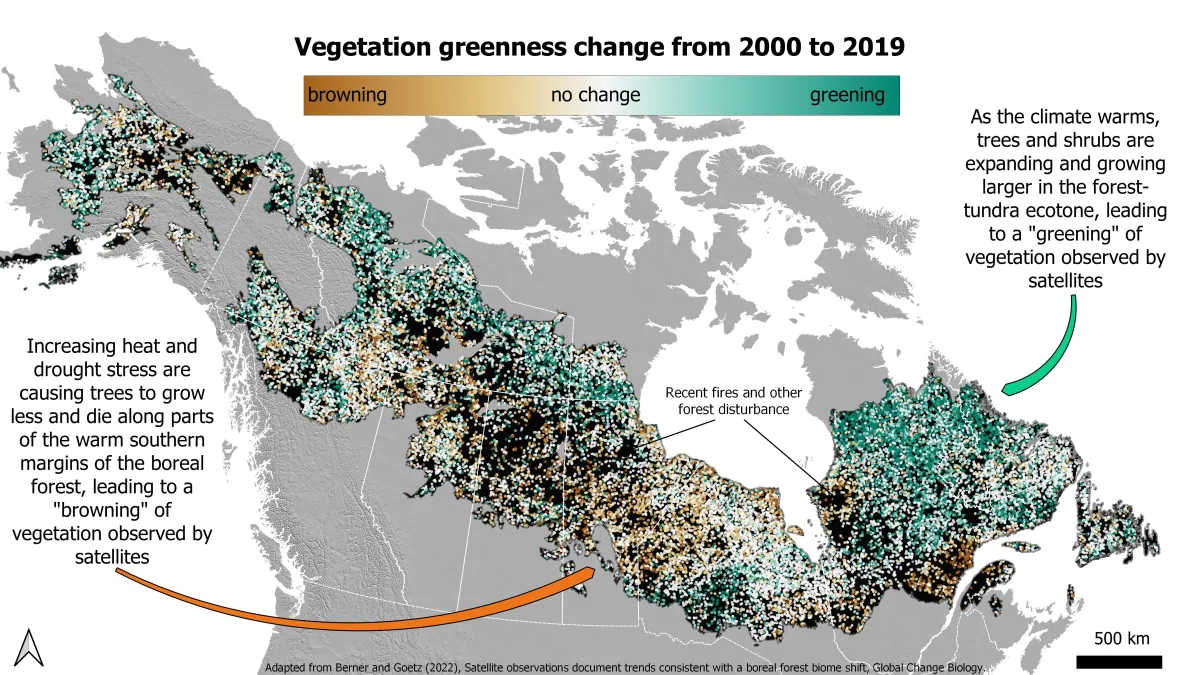
As the climate warms, heat stress and drought cause trees at the southern margins of the boreal forest to die off. At the northern margins, warmer temperatures allow trees to expand. This pattern of “browning” and “greening” might shift boreal forests north.
Watch the video above or read the full piece to read more about boreal biome shift and other ways climate change is affecting Earth’s boreal forests.
New study shows Earth’s coldest forests are shifting northward
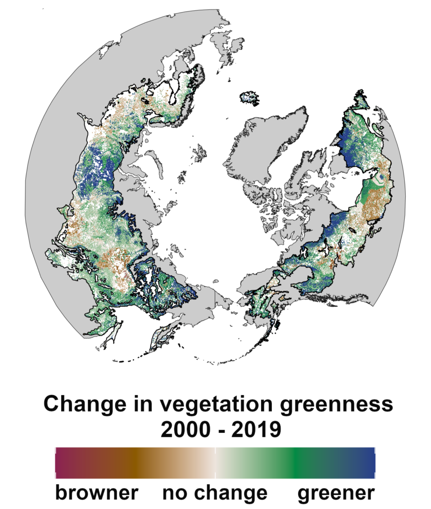
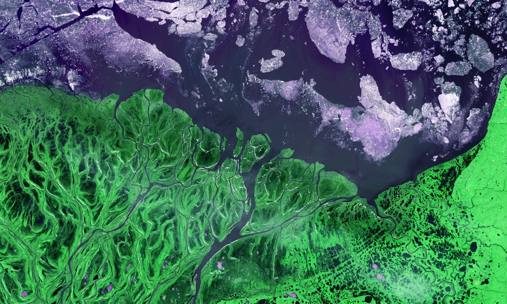
New research from the GEODE Lab shows rising temperatures are causing Earth’s coldest forests to shift northward. Drs. Logan Berner and Scott Goetz authored a new article, “Satellite observations document trends consistent with a boreal forest biome shift,” that was recently published in Global Change Biology. The study focused on the boreal forest, which is a belt of cold-tolerant conifer trees that stretches nearly 9,000 miles across northern North American and Eurasia. The boreal forest accounts for almost a quarter of the Earth’s forest area and is the mostly rapidly warming forest biome. The researchers looked at several decades of moderate-resolution satellite observations and assessed where and why vegetation became greener and browner during recent decades. “Our study shows climate change is causing boreal trees and shrubs to expand into arctic and alpine tundra, while at the same time causing trees to become more stressed and die along the warm southern margins of the boreal forest,” Berner said. “These dynamics could lead to a gradual northward shift in the geographic extent of the boreal forest biome.” Such a boreal biome shift could have consequences for wildlife, wildfires, and climate feedbacks related to carbon cycling and surface albedo. This study was part of a larger initiative funded by NASA’s Arctic-Boreal Vulnerability Experiment (ABoVE) that will involve further efforts to understand the extent, nature, cause and consequence of an emerging boreal biome shift. Goetz is the science lead for ABoVE.
Read more about the research from the American Geophysical Union’s science news outlet, Eos.
For a short listen, check out a radio news story about the research from KNAU.
For a longer listen, tune in to an in-depth interview with Dr. Berner from ‘Eyes on Earth,’ a science podcast from the USGS.
Understanding animal and human activity through audio
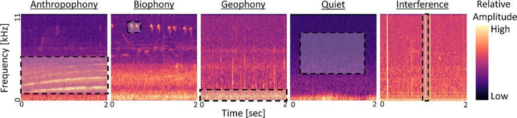
The Soundscapes to Landscapes (S2L) project focuses on using acoustic data collected across the hills and forests of Sonoma County, California, and linked with remote sensing data to better monitor biodiversity. The GEODE lab’s Colin Quinn, Patrick Burns, and Scott Goetz along with five other non-GEODE collaborators published work where they applied deep learning methods to classify animal and human activity patterns in 500,000 minutes worth of acoustic data, the equivalent of recording continuously for just under one year, from Sonoma County, California. The work demonstrates how a large amount of acoustic data can be classified into ecologically meaningful categories of activity and how patterns in acoustic activity relate to landscape characteristics such as land use and proximity to roads. These data will be used to map animal activity, human presence, and naturally quiet landscapes across Sonoma County using GEDI and other NASA remote sensing products. In addition to understanding broad patterns in sound, the S2L project focuses on classifying and mapping common bird species from the acoustic dataset with the help of countless citizen scientists. The potential impact of S2L work was described in a recent article in Bay Nature.
A New Hope for the GEDI mission? Scientists fight to keep lidar on the International Space Station
GEODE lead and GEDI deputy principal investigator Scott Goetz is joining forces with other GEDI team members and remote sensing scientists across the globe to fight to keep GEDI lidar on the International Space Station. The Global Ecosystem Dynamics Investigation (GEDI) successfully sent a lidar sensor to space in 2018. Since then, the instrument’s lasers have been providing scientists with a three-dimensional view of Earth’s forests. Slated for decommissioning 2023, scientists are banding together to save GEDI. As we approach a crossroads in the battle against climate change, data provided by the GEDI mission is more crucial than ever for understanding carbon storage in our forests. Read more about Scott and the other’s fight here.
Spread the word to help save GEDI!
NAU, partner institutions selected for international sustainability award
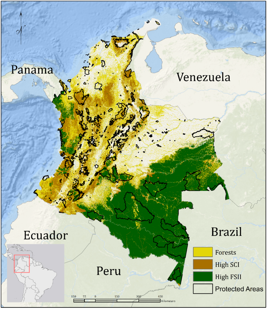
Northern Arizona University is a key partner in a project that has been recognized for its work in achieving one of the United Nations Development Program (UNDP) Sustainable Development Goals, which are designed to protect and sustain all life on Earth amid a changing climate. NAU’s contribution to this effort comes in the form of new satellite-derived datasets and indicators on high-integrity forest fragmentation and the extent and condition of riparian forests in Peru, Colombia and Ecuador. GEODE lab members include Patrick Jantz, Ivan Gonzalez, Patrick Burns and Scott Goetz. Gonzalez coordinates activities with UNDP country offices and environment ministries in the three countries.
Read more about it here, including quotes from NAU’s President Cruz and the executive director of the Group on Earth Observation (GEO) Initiative on Sustainable Development Goals. The award ceremony was held the week 22 November 2021.
Fate of the Caribou
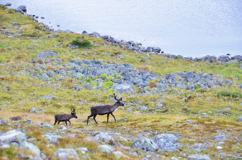
Wild caribou are the single most important land-based species for both human communities and ecosystems in the Arctic. Abundant across the polar region, these animals play an essential role both as herbivores that impact tundra vegetation and as an important source of food to Indigenous hunters. In many cultures, the caribou also have incalculable spiritual value.
Despite their clear importance and presence on the landscape, the fate of caribou in the face of a warming Arctic still remains unclear. Arctic regions are experiencing rapid rates of climate warming, which in turn weave a complex web of downstream effects. At the same time, the pace of human development is accelerating. Understanding how caribou will fare is of the utmost importance, but most existing studies focus on one or two caribou herds, which makes it difficult to generalize to the whole species.
“The Arctic is getting warmer, busier, and potentially riskier for caribou”
Logan Berner
The GEODE lab’s Scott Goetz (Regent’s Professor) and Logan Berner (Assistant Research Professor) seek to change this with a new research project funded with Elie Gurarie (State University of New York) and Mark Hebblewhite (University of Montana) as part of the National Science Foundation’s Navigating the New Arctic program.
“Fate of the Caribou: from local knowledge to range‐wide dynamics in the changing Arctic” is a new interdisciplinary research project that will implement large-scale analyses across several caribou herds in North America. This work tackles the complicated interplay between caribou, climate, and the natural and built environments. The science will be co-produced with indigenous-led caribou and natural resource management boards and the findings and data products will advance understanding of caribou dynamics and assist managers and scientists in making well-informed decisions to promote the health of caribou herds across the Arctic.
“It is crucial that we consider and value the deep knowledge of people who have lived in these northern landscapes for many millennia. We try to combine that deep knowledge with the strengths of western science to better understand the world in a more holistic manner. There’s so much intimate understanding that’s gleaned from living in a landscape. It’s the sort of thing we can’t see with a satellite.”
Logan Berner
Learn more about this research at NAU News.
Watch the GEODE lab’s Logan Berner discuss the project on the AZ Family nightly news!
Read The Wildlife Society’s take here.
GEODE lab postdoctoral researcher Chris Hakkenberg named NEON ambassador in inaugural cohort
The National Science Foundation’s National Ecological Observatory Network (NEON) has announced its inaugural cohort of NEON ambassadors. The list includes three NAU researchers: School of Informatics Regents’ Professor Andrew Richardson, School of Informatics director Benjamin Ruddell and the GEODE lab’s very own Chris Hakkenberg.
New this year, the NEON Ambassador Program seeks to “empower and connect researchers and educators eager to engage with their communities.”
Through the program, ambassadors will get an in-depth look at NEON’s resources and learn more about NEON’s user community. With this knowledge they will be well equipped to accelerate scientific discovery, bring educational opportunities back to their communities, inform public policy, and advocate for diversity and inclusion in science.
This first cohort will have the privilege of shaping what the Ambassador Program will look like into the future.
Congratulations to Chris and all of the other ambassadors!
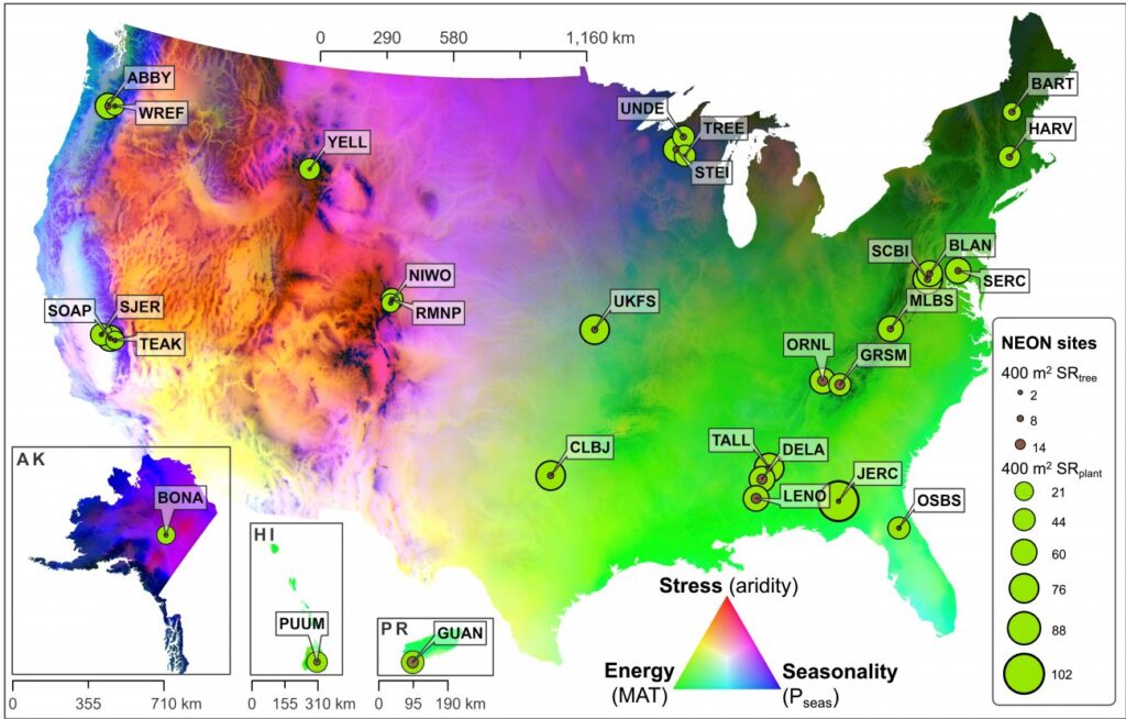
Exploring Interrelationships Between Plant Biodiversity, Forest Structure, and Climate
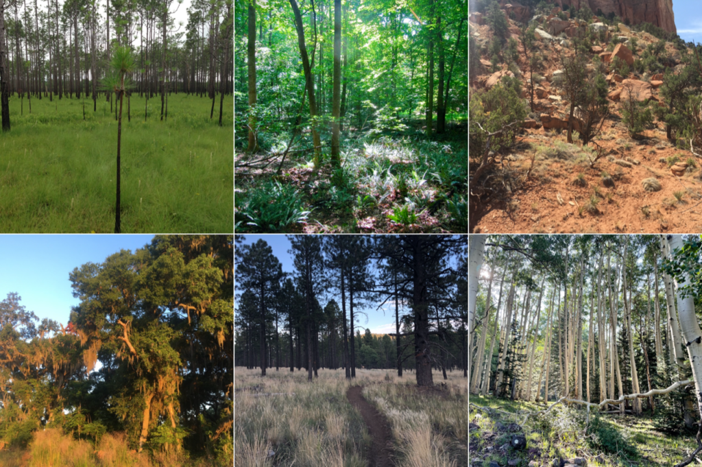
Plant biodiversity is one of the key indicators of ecosystem health and productivity. It is also difficult to estimate at large scales. Forest structure has increasingly been recognized as a way to approximate patterns in the distribution of biodiversity. But how well do biodiversity-structure relationships hold up across climate zones?
“If we look at biodiversity-structure relationships across regions, we see noticeable differences between, say, Washington state and Florida. But why should that be? What is driving those disparities? By quantifying how climate differs between regions, we can start to develop a three-way relationship between climate, biodiversity and forest structure that lets us explore how climate may be mediating the relationship between the other two.”
Chris Hakkenberg
A new study by Drs. Christopher R. Hakkenberg and Scott J. Goetz, recently published in Global Ecology and Biogeography, uses lidar and field observations from the NEON program to explore how climate mediates biodiversity-structure relationships (BSRs) across the United States. Their findings could help improve biodiversity maps created with remote sensing data and better predict the impact of habitat degradation and climate change on biodiversity across disparate regions.
“The big takeaway here is that climatic context plays a substantial role in how forest structure relates to plant diversity”
Chris Hakkenberg
Read a full write up about Chris and Scott’s work at NEON’s website, here.
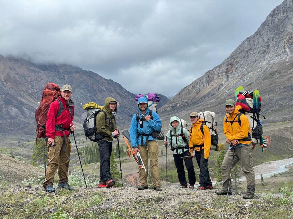
Fieldwork report: Trekking through Alaska’s Brooks Range
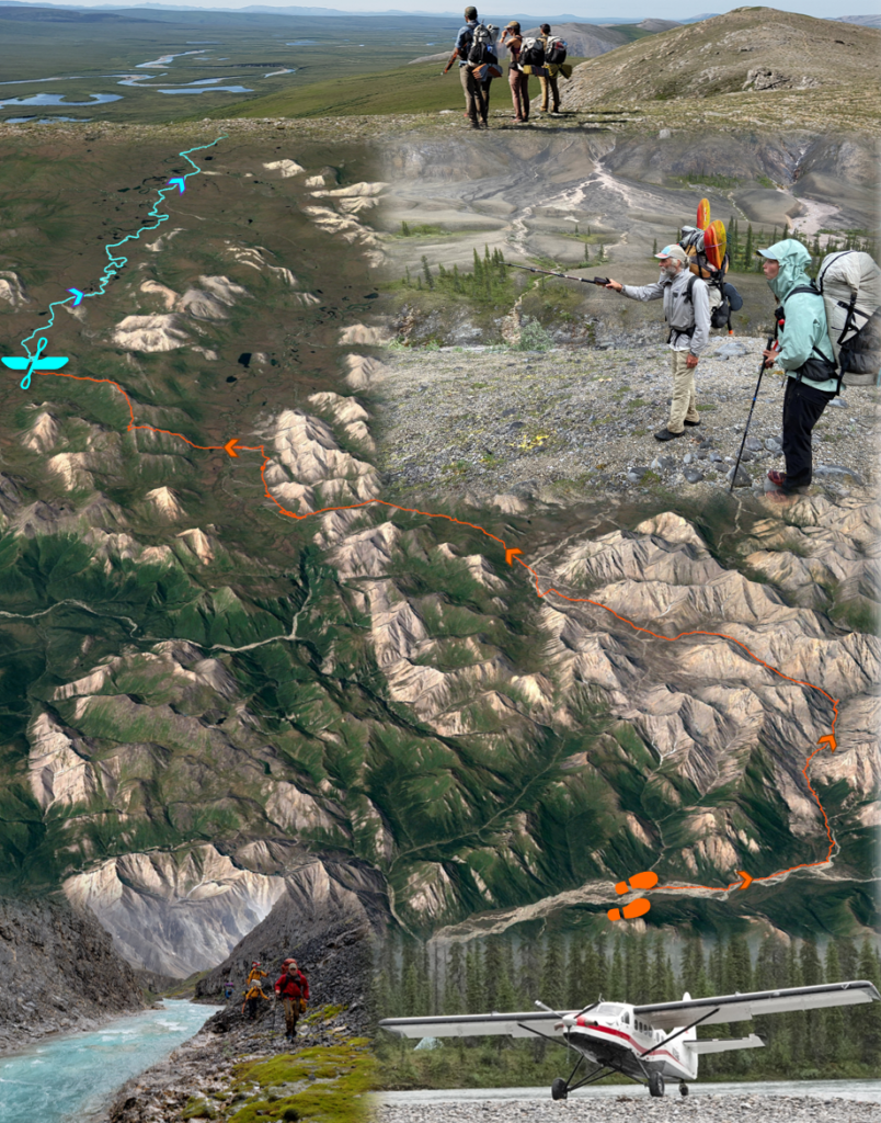
To better understand recent greening and browning in northern Alaska, Professor Roman Dial and his team from Alaska Pacific University (APU) have spent recent summers collecting extensive ecological observations while trekking throughout Alaska’s Brooks Range. They were joined in July 2021 by Dr. Logan Berner and Patrick Burns who are ABoVE Science Team members in the GEODE Lab led by Dr. Scott Goetz at Northern Arizona University. During the course of 11 rain-soaked days, the research team trekked ~80 miles from the northern edge of boreal forest into the Noatak Wilderness where trees give way to thickets of shrubs, wetlands, and barren rocky ridges. While trekking, the researchers collected ecological field data to be linked with measurements of vegetation greenness derived from Landsat satellite observations. Rather than establish time-consuming field plots, then instead used a new technique called “pixel-walking” that harnesses the multifunctionality of smartphones to record and geolocate visual observations of vegetation composition and density while trekking across the landscape. This approach, pioneered by Dial, makes it possible to collect far more spatially extensive information on plant community composition and structure than can be derived from field plots alone. During summer 2021, Dial’s research team pixel-walked over 800 miles from east to west through the Brooks Range, collecting data on vegetation composition for ~100,000 Landsat pixels. Over the coming year, Dial’s team will work with Berner, Burns, and Goetz to link these extensive field data with several decades of Landsat satellite observations. This collaboration will help unravel the mysteries of Arctic greening and browning by shedding light on where, how, and why plant communities changed in recent decades.
Read more about Logan and Pat’s trek in NASA’s Notes from the Field.