
Drivers and Impacts of Reburning in boreal forest Ecosystems (DIRE)
lead
Xanthe Walker (NAU)
C0-leads
Logan Berner, Scott Goetz
keywords
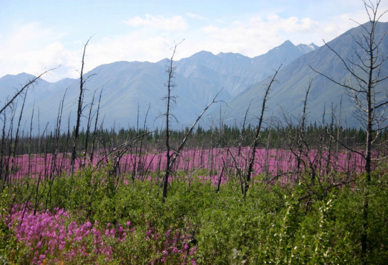
Boreal forest, reburn, stand age, remote sensing, fire return interval, vegetation successional trajectories, climate change
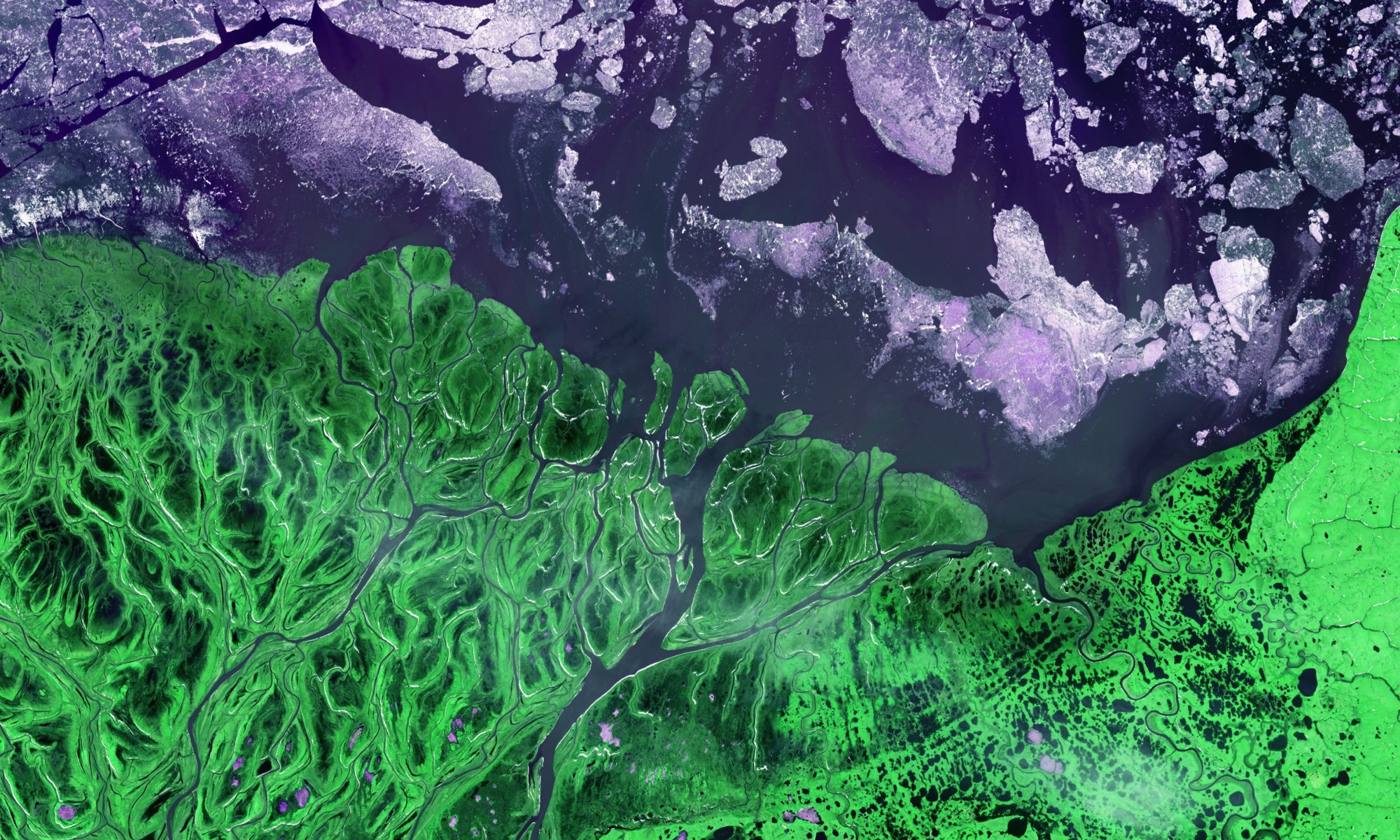
Historically, northern ecosystems have acted as a net carbon (C) sink, accumulating C from the atmosphere over centuries. However, as the climate warms wildfire disturbance has become more frequent and more intense, with rapid impacts on the structure and function of high-latitude ecosystems. Research has shown that shorter fire return intervals, or reburning, can shift northern ecosystems to become net C sources. This projects seeks to fill the critical research gap of understanding where and when reburning occurs and the consequences of reburning for post-fire vegetation successional trajectories throughout the ABoVE Domain. Remote sensing is essential for assessing these reburning dynamics across large spatial and temporal scales and ultimately forecasting the resilience or vulnerability of boreal forest ecosystems under a warming climate.
This project is part of ABoVE. More information about this project can be found here.
Integrating remotely sensed data with a boreal forest model to predict long-term climate change impacts across Alaska and Western Canada
lead
Shelby Sundquist
keywords
Boreal forest, ecological modeling, remote sensing, climate change
Climate change in the boreal zone is driving increased disturbance rates, higher mortality, and rapid shifts in forest composition. Ecological models allow us to predict responses to changing environmental conditions and test the importance of uncertain factors like forest management or future drought for forest change. This research applies the University of Virginia Forest Model Enhanced (UVAFME) to predict climate impacts on boreal forests through the end of the 21st century. We implemented new procedures in UVAFME to initialize modeled forests with satellite data and dynamically simulate future forest management. This work will demonstrate the importance of initial conditions for near-term model predictions, capability of adaptive forest management to maintain ecosystem services, and sensitivity of the boreal forest to future droughts.
More information about this project can be found here.
Fire Self Regulation in boreal forest ecosystems (FiSL)
lead
Michelle Mack
co-lead
Scott Goetz, Logan Berner, Adrianna Foster
keywords
Boreal forest, climate change, fire, remote sensing, modeling, mapping
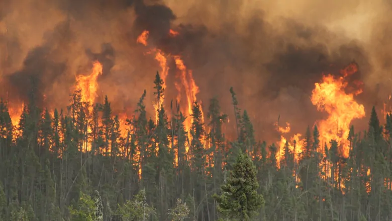
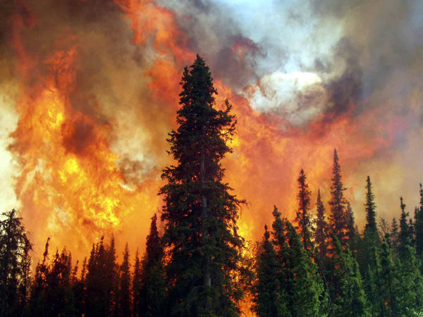
Arctic and boreal forests, tundra, and cold underlying soils together store 30% of the world’s terrestrial carbon, an amount twice that currently stored in the atmosphere. As the climate warms, Arctic and boreal wildfires are becoming more frequent and intense, burning larger areas. These fires release older carbon to the atmosphere, and by doing so could affect global climate, change the forest ecosystems, and possibly slow climate-driven increases in fire activity. This project explores feedbacks between fire and vegetation, also called fire self-regulation. It is addressing two primary questions: (1) What is the current evidence for the ecological process of fire self-regulation, and can it slow the effects of climate warming on fire activity? (2) How does consideration of fire self-regulation affect projections of future ecosystem and landscape structure, function, and climate forcing? This work uses field and remote sensing data to quantify previous patterns and simulation modeling to predict current and future ecological dynamics. The results will inform improved tools for wildland and fire managers across Alaska, assisting with efforts to mitigate wildfire effects on residents and critical infrastructure.
More information about this project can be found here.
Mapping and modeling attributes of an Arctic-Boreal biome shift
lead
Scott Goetz
keywords
Arctic tundra, boreal forest, remote sensing, climate change, modeling, vegetation, mapping, shrub, lichen
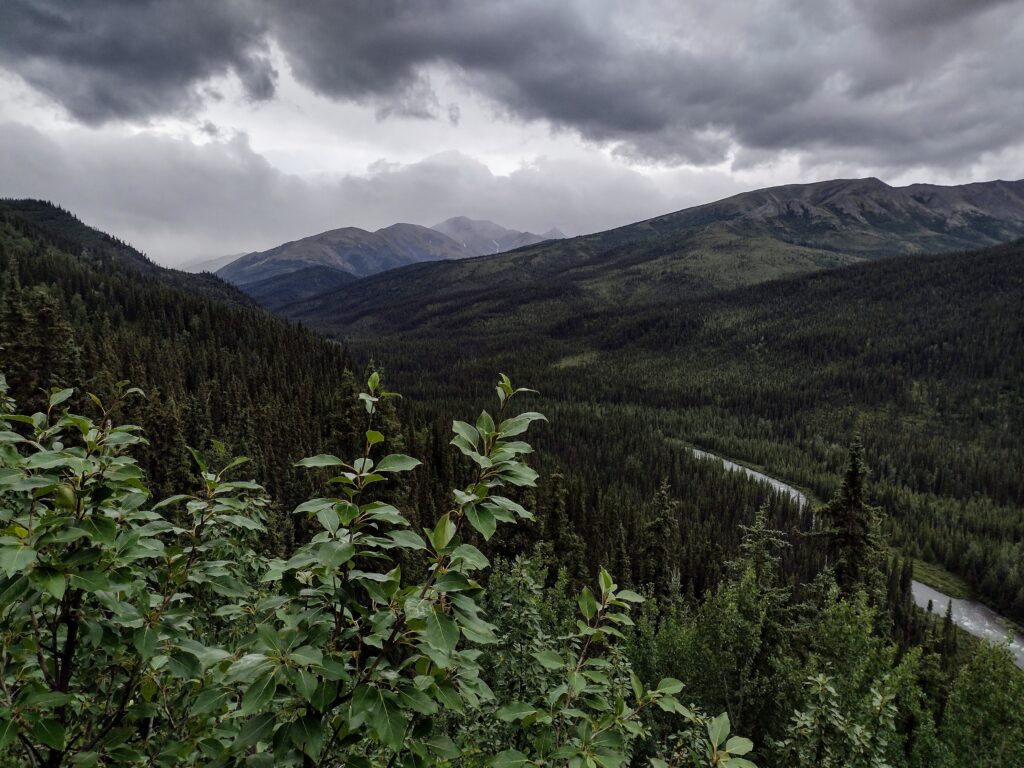
This project, part of the Arctic Boreal Vulnerability Experiment (ABoVE), is designed to assess the evidence for vegetation changes and transitions consistent with expectations of a biome shift resulting from changing climate in the high latitudes of North America. Over all three phases of ABoVE, this project has leveraged satellite data, airborne imagery, field measurements and process-based modeling to investigate multiple lines of evidence for the progression of a boreal biome shift, where tree productivity decreases and mortality increases in the southern boreal while suitability for range expansion and densification of woody vegetation (e.g. trees and shrubs) increases in the northern boreal and arctic tundra. Furthermore, we are investigating the implications of such a shift on both flora and fauna, and exploring options for resource management adaptation to change.
This project is part of ABoVE. More information about this project can be found here.