
Global Ecosystem Dynamics Investigation

Lead
Ralph Dubayah (UMD)
co-lead
Scott Goetz, Patrick Jantz, Patrick Burns
Keywords
Lidar, canopy height, canopy structure, above-ground biomass, surface topography, international space station, carbon cycle, biodiversity
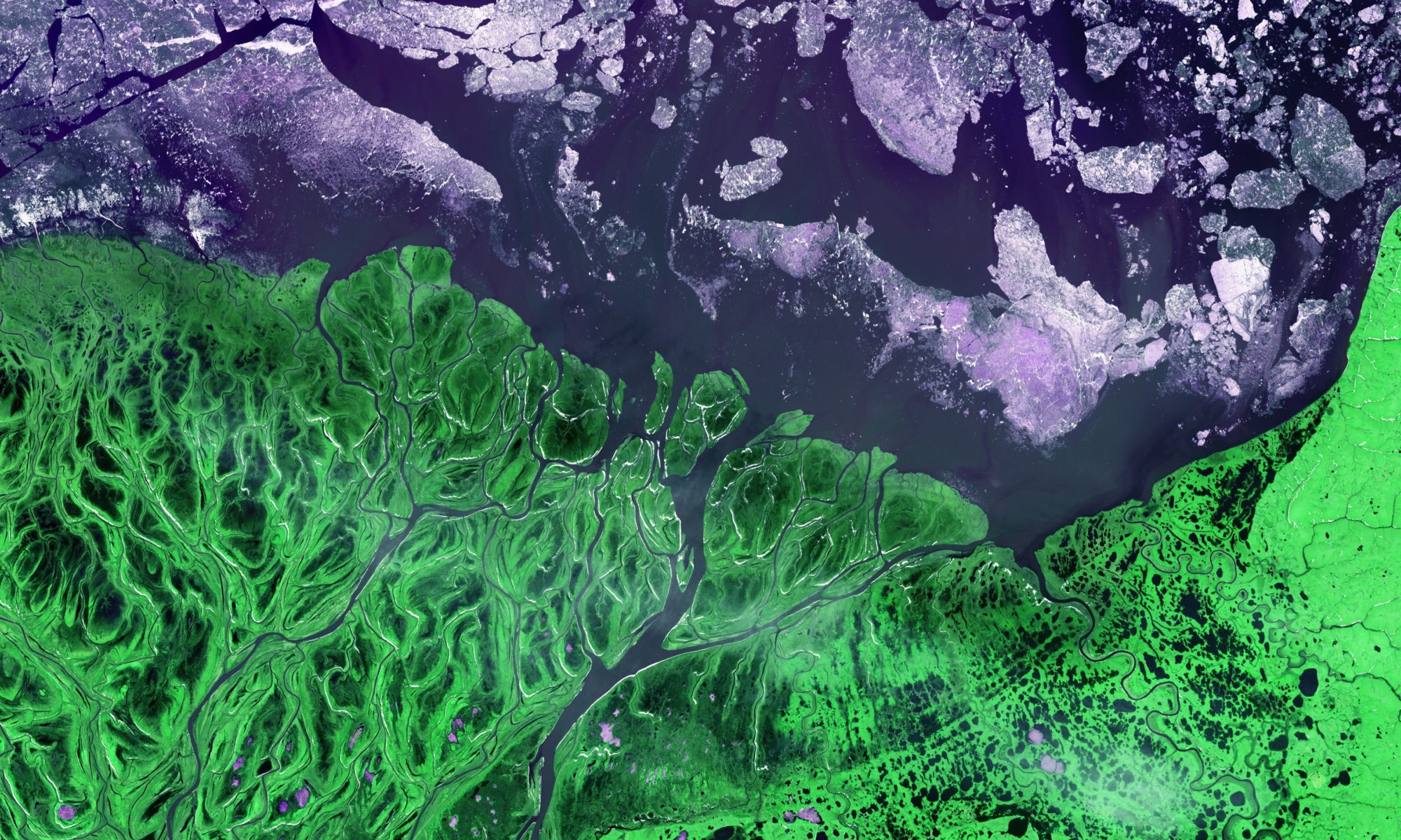
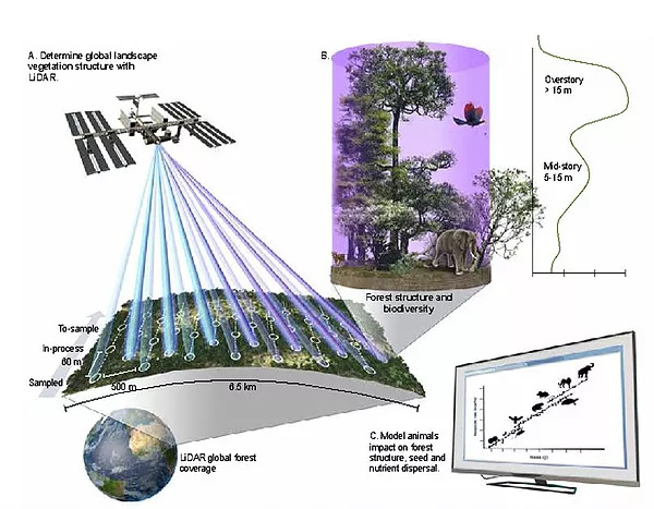
Global Ecosystem Dynamics Investigation (GEDI) is a NASA Earth Venture mission designed to build, launch, and install a lidar (Light Detection and Ranging) instrument on the International Space Station, and derive a suite of forest canopy structure and biomass products. The GEDI lidar will fire billions of laser shots at the surface over the earth over its 2-year operational period (2019-2020) that will allow the science team to map forest canopy heights, canopy three-dimensional structure, above-ground biomass, and surface topography with unprecedented accuracy. GEDI data products will be useful for a range of science applications with societal benefits, including informing models of carbon and water cycling processes, biodiversity and habitat mapping, weather forecasting, forest management, glacier and snowpack monitoring, and more accurate elevation models of the earth’s surface.
This short video gives an excellent overview of the GEDI mission:
For more details, see the full story here.
More information about GEDI can also be found here or by clicking the project title, above.
Informing UN-assisted National Biodiversity Strategy Action Plans with earth observations
Lead
Andy Hansen (Montana State University)
co-lead
Patrick Jantz, Scott Goetz
Keywords
Habitat fragmentation, forest integrity, connectivity, biodiversity, united nations development program, remote sensing
Human activities are increasingly fragmenting intact habitats and reducing connectivity among protected areas. The United Nations Development Program (UNDP) is working with 135 countries to implement National Biodiversity Strategy Action Plans (NBSAPs) to minimize and mitigate impacts of habitat fragmentation on biodiversity. We are working closely with the UNDP to (1) develop satellite-based products that are global in extent, but also relevant at the regional level for mapping forest integrity and assessing habitat fragmentation and connectivity; and (2) use the products to inform a decision support system (DSS) hosted by the UN Biodiversity Lab that includes tools for summarizing regional data, evaluating forest condition and trends, and communicating results to stakeholders. These products and tools have the potential to improve the transparency, consistency, and sustainability of land use decisions in developing countries.
See here for additional information.
Quantifying Forest Vertical Structure Using Spaceborne Lidar: A GEOBON Essential Biodiversity Variable Application in Colombia
lead
Patrick Jantz
co-lead
Scott Goetz
Collaborators
Ralph Dubayah (University of Maryland), Susana Rodríguez-Buriticá (Humboldt Institute, Colombia), Maria Londoño (Humboldt Institute, Colombia)
keywords
Habitat vertical structure, biodiversity, lidar, GEDI, essential biodiversity variables
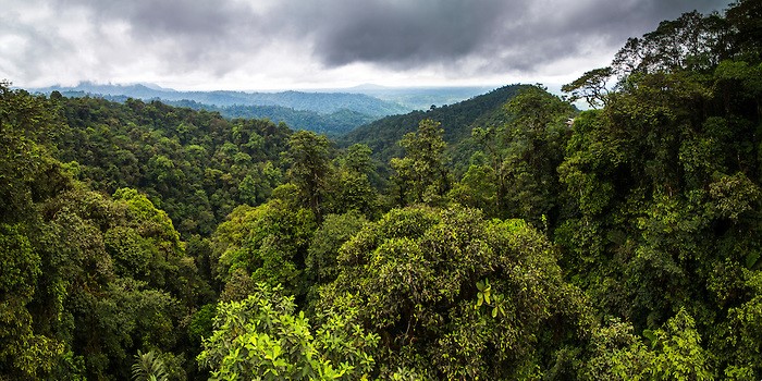
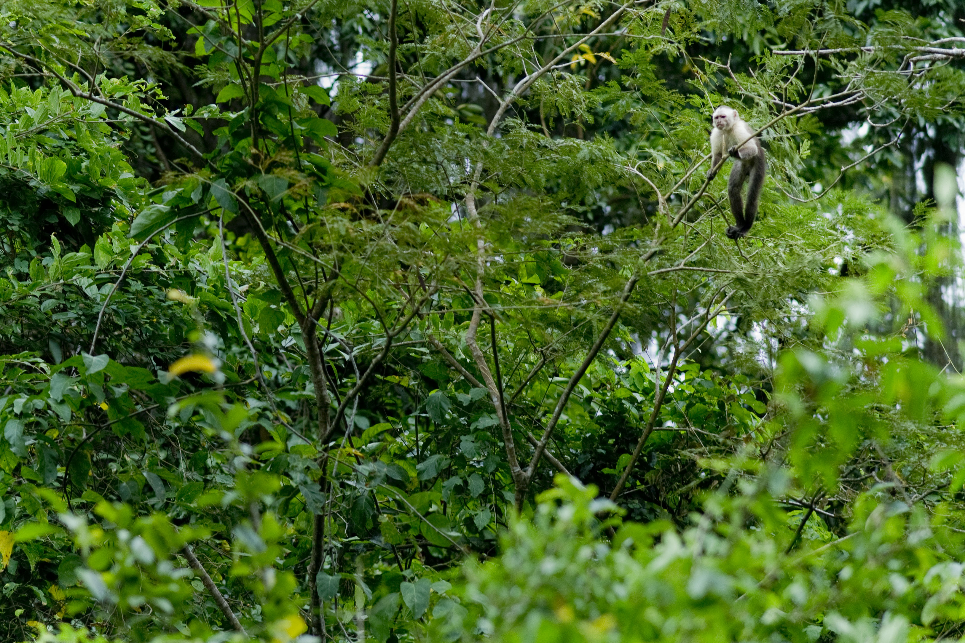
Habitat vertical structure has emerged over the last several decades as an important predictor of biodiversity. Habitat structure predicts habitat use for a range of animals and is correlated with plant species diversity in a range of forest ecosystems. Currently, national biodiversity assessments in developing tropical countries rely on field inventories or aircraft lidar measurements to characterize habitat vertical structure. These data have proven vital for understanding how land use and biophysical factors influence habitat structure but tend to be sparsely sampled, allowing only coarse grained reporting on habitat structure. Densely sampled lidar data from the Global Ecosystem Dynamics Investigation (GEDI) promise to fill important gaps in our understanding of habitat vertical structure. The Colombian government, in collaboration with The Group on Earth Observations Biodiversity Observation Network (GEO BON), is currently developing a national biodiversity observation network. We have developed a forest structure Essential Biodiversity Variable (EBV) designed to inform this network. Using an extensive database of aircraft and spaceborne lidar, we characterized and classified forest vertical structure using variables that represent primary dimensions of forest structure: canopy height, canopy cover, and canopy vertical distribution. Initial results indicate that hierarchical clustering approaches distinguish ecologically meaningful classes, especially those classes that represent tall, vertically complex forest which are conservation priorities in areas dominated by secondary growth. The forest structure EBV framework provides a quantitative basis for defining and estimating the extent of locally relevant forest structure types, a critical step forward for assessing national progress towards Aichi biodiversity targets and Sustainable Development goals.
Learn more about GEO BON here, and more about this project here.
Adding space-based vegetation structure measurements to a global ecosystem model to simulate tropical forest animal communities and their role in ecosystem function
Lead
Chris Doughty (NAU)
Co-leads
Patrick Jantz, Scott Goetz, Patrick Burns
keywords
Forest structure, lidar, land use, climate change, biodiversity, ecosystem services
This project aims to enhance the Madingley ecological model by including measurements of forest structure from a space based lidar instrument and improving parameterizations of 3D animal habitat use. These advances will allow us to use scenarios of land use and climate change to investigate potential biodiversity impacts at local, regional, and pan-tropical scales. The enhanced Madingley model will also allow us to better predict animal ecosystem services like carbon sequestration and nutrient dispersal across the tropics.
For more information see here.
Maintaining life on land (Sustainable Development Goal 15) under scenarios of land use and climate change in Colombia, Ecuador, and Peru
lead
Andy Hansen (Montana State University)
co-lead
Patrick Jantz, Scott Goetz
keywords
Ecosystem structure, climate change, biodiversity, habitat, conservation
This project will support the development of indicators of ecosystem structure and composition, vertebrate habitats, and water resource risk under future climate and socioeconomic scenarios in Colombia, Ecuador, and Peru. The approach and methods will be incorporated into the United Nations Development Program (UNDP) decision support system, the UN Biodiversity Lab, a platform designed to deliver geospatial data to over 140 countries to support national conservation decision-making.