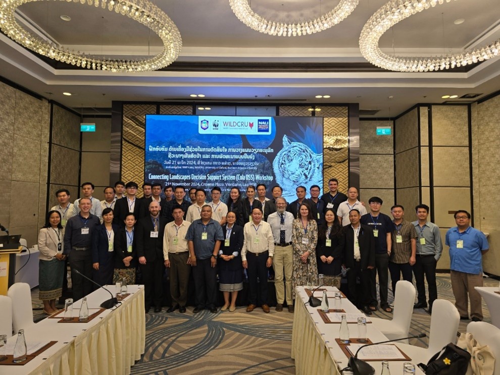
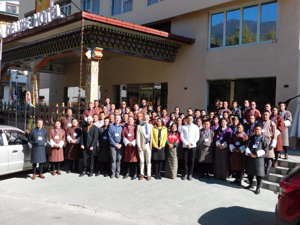
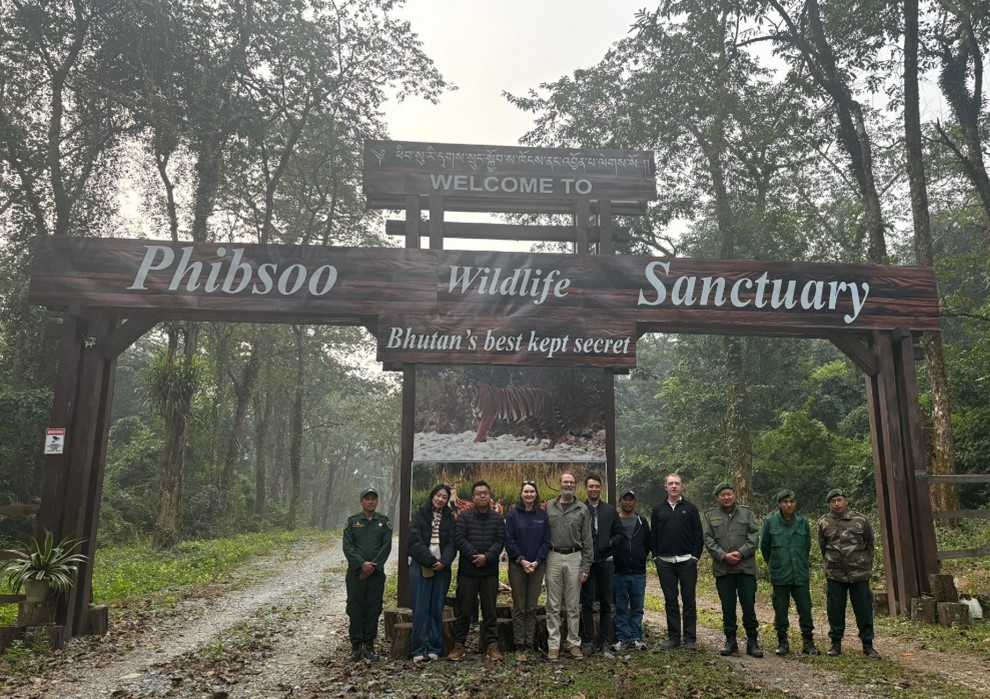
GEODE lead Scott Goetz elected fellow of the American Geophysical Union

Our very own GEODE lead and NAU Regents’ professor Scott Goetz was recently elected a fellow of the American Geophysical Union (AGU). AGU is a global community of more than half a million advocates and professionals in the Earth and space sciences. The AGU Fellows program honors members who have made exceptional contributions to science. Fellows make up only 1/10th of 1% of the current year active AGU membership, and are considered the foremost experts in their field. Scott was elected for advancing understanding of changes in the global terrestrial biosphere using remote sensing observations. He and the other honorees will be recognized at AGU23 in San Francisco, December 11-15.

A well deserved honor, and congratulations to Scott!

Landscape-scale benefits of protected areas for tropical biodiversity

At the Conference of Parties to the Convention on Biological Diversity (CBD) in Montreal, Canada this past winter, nations committed to protecting 30% of the world’s lands and oceans by 2030.

The ’30 x 30′ goal relies on the creation of protected areas, but uncertainties remain about the effectiveness of these protected areas. Encouragingly, recent research led by Jedediah Brodie at the University of Montana, and contributed to by GEODE members Scott Goetz, Patrick Burns, Patrick Jantz, Chris Hakkenberg and Zaneta Kaszta suggests protected areas are associated with higher vertebrate biodiversity. Not only that, but researchers also found that large protected areas were associated with increased mammal diversity in adjacent unprotected areas, a concept called ‘spillover.’

Learn more here, or head straight to the science!

a) PAs such as national parks can reduce habitat loss and degradation (from logging) and extractive behaviors such as hunting (shown in red circle), but there are a wide range of real-world outcomes based on management effectiveness. b) PAs are aimed at safeguarding multiple facets of biodiversity, including species richness (SR), functional richness (FR) and phylogenetic diversity (PD). c) Wildlife communities inside PAs and in the surrounding landscape may exhibit distinct levels and types of diversity.

Mapping an uncertain future for Arctic boreal forests

Ecological memory stored in a landscape can help an ecosystem recover from disturbances like fire and outbreaks of disease. But what happens when climate warming disrupts that process? How long before ecological memories stored in the warming Arctic are overwritten by new ones, and what does that mean for the Arctic’s future? 

A team led by NAU investigators Michelle Mack, Ted Schuur, Xanthe Walker and GEODE members Logan Berner and Scott Goetz has been awarded $9.6M from the National Science Foundation to study how Alaska’s boreal forests are adapting to a changing climate, and how humans influence the future of these ecosystems.

Read the full story here!

Ancient subarctic forests at risk from climate change and war

Data from satellite imagery suggests a boreal forest biome shift might be underway. Boreal “greening” was found predominantly along the coldest, northernmost margins of the boreal forest biome, whereas “browning” was found most often along the warmest, southern margins of the biome. Read the full paper here: https://doi.org/10.1111/gcb.16121

Great read about the perils faced by Earth’s boreal forest. On one front, climate change threatens these northernmost forests, causing increasing wildfire activity, permafrost thaw, biome shifts and carbon release. Complicating matters is the Russia-Ukraine war, which stymies international collaboration and “black boxes” Russia’s half of our boreal forests.

Read the full story here.

GEODE lead Scott Goetz and assistant research professor Logan Berner contributed to the reporting, as did a wide array of scientists and land managers from across the globe.

The GEODE lab is seeking a Postdoctoral Researcher!

The GEODE Lab in the Ecological Informatics program at Northern Arizona University (Flagstaff) is seeking a Postdoctoral Researcher to work on a range of projects.  We seek someone with strong technical skills to make extensive use of remote sensing image and lidar data in a high performance computing environment, advancing projects focused on mapping, monitoring and modeling broad scale ecosystem changes, incorporating climate, land use and disturbance.  A PhD degree in a relevant discipline is required.  Additional information and details can be found here.

Climate change is warming Canada’s great expanse of boreal forest, bringing greater risk of fire and disease

GEODE assistant research professor Logan Berner speaks to the CBC about changes underfoot in the boreal forest:

“There is emerging evidence that as the climate continues to warm, the boreal might shift northward”

As the climate warms, heat stress and drought cause trees at the southern margins of the boreal forest to die off. At the northern margins, warmer temperatures allow trees to expand. This pattern of “browning” and “greening” might shift boreal forests north.

Watch the video above or read the full piece to read more about boreal biome shift and other ways climate change is affecting Earth’s boreal forests.

New study shows Earth’s coldest forests are shifting northward

New research from the GEODE Lab shows rising temperatures are causing Earth’s coldest forests to shift northward. Drs. Logan Berner and Scott Goetz authored a new article, “Satellite observations document trends consistent with a boreal forest biome shift,” that was recently published in Global Change Biology. The study focused on the boreal forest, which is a belt of cold-tolerant conifer trees that stretches nearly 9,000 miles across northern North American and Eurasia. The boreal forest accounts for almost a quarter of the Earth’s forest area and is the mostly rapidly warming forest biome. The researchers looked at several decades of moderate-resolution satellite observations and assessed where and why vegetation became greener and browner during recent decades. “Our study shows climate change is causing boreal trees and shrubs to expand into arctic and alpine tundra, while at the same time causing trees to become more stressed and die along the warm southern margins of the boreal forest,” Berner said. “These dynamics could lead to a gradual northward shift in the geographic extent of the boreal forest biome.” Such a boreal biome shift could have consequences for wildlife, wildfires, and climate feedbacks related to carbon cycling and surface albedo. This study was part of a larger initiative funded by NASA’s Arctic-Boreal Vulnerability Experiment (ABoVE) that will involve further efforts to understand the extent, nature, cause and consequence of an emerging boreal biome shift. Goetz is the science lead for ABoVE.

Read more about the research from the American Geophysical Union’s science news outlet, Eos.

For a short listen, check out a radio news story about the research from KNAU.

For a longer listen, tune in to an in-depth interview with Dr. Berner from ‘Eyes on Earth,’ a science podcast from the USGS.

Understanding animal and human activity through audio

Spectrograms of five soundscape classes. These spectrograms show time (x-axis) relative to sound frequency (y-axis) and sound amplitude (color) for 2-second sound recordings. Patterns unique to each soundscape class are shown by the black hashed boxes.

The Soundscapes to Landscapes (S2L) project focuses on using acoustic data collected across the hills and forests of Sonoma County, California, and linked with remote sensing data to better monitor biodiversity. The GEODE lab’s Colin Quinn, Patrick Burns, and Scott Goetz along with five other non-GEODE collaborators published work where they applied deep learning methods to classify animal and human activity patterns in 500,000 minutes worth of acoustic data, the equivalent of recording continuously for just under one year, from Sonoma County, California. The work demonstrates how a large amount of acoustic data can be classified into ecologically meaningful categories of activity and how patterns in acoustic activity relate to landscape characteristics such as land use and proximity to roads. These data will be used to map animal activity, human presence, and naturally quiet landscapes across Sonoma County using GEDI and other NASA remote sensing products. In addition to understanding broad patterns in sound, the S2L project focuses on classifying and mapping common bird species from the acoustic dataset with the help of countless citizen scientists. The potential impact of S2L work was described in a recent article in Bay Nature.