
Pan-Arctic vegetation biomass mapping
lead
Katie Orndahl
C0-lead
Logan Berner
keywords
Pan Arctic; plant biomass; woody plant dominance; vegetation distribution; remote sensing; climate change; Landsat
Arctic ecosystems are warming faster than anywhere else on Earth. This warming influences ecosystem processes and alters carbon balance across the Arctic, placing the region at the forefront of global climate change. Vegetation plays a crucial role in shaping the Arctic’s future by both responding to changes in climate and modulating potential changes. The distribution of vegetation across the landscape also influences the health and behavior of human and wildlife communities. To fully understand the status of Arctic ecosystems and how they are likely to change in the future, quantification of the distribution, extent and structure of Arctic vegetation is critical. Plant biomass is a fundamental ecosystem attribute that is sensitive to changes in climate, closely tied with ecological function and crucial for determining ecosystem carbon storage. This makes it a high priority characteristic for inventory and monitoring.
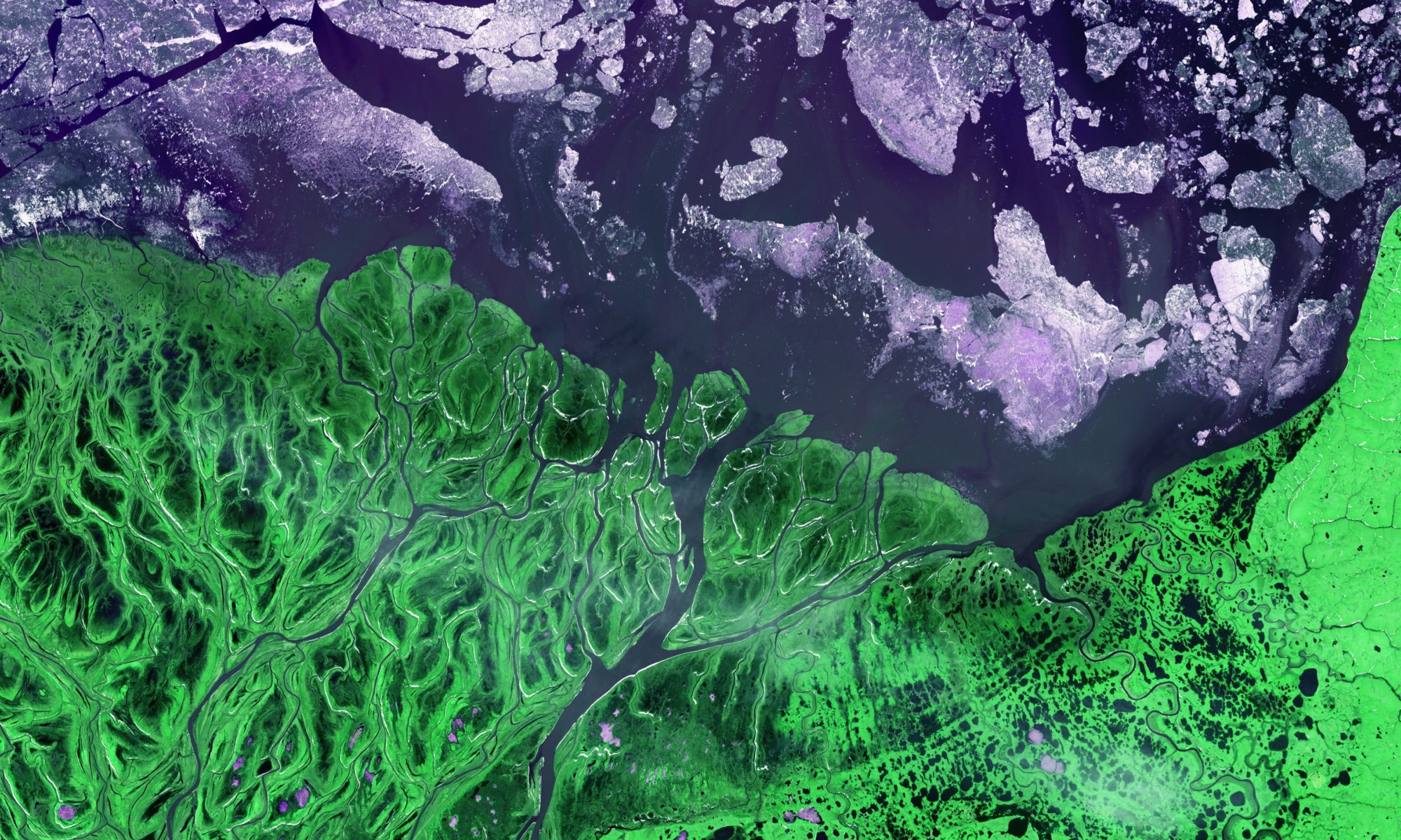
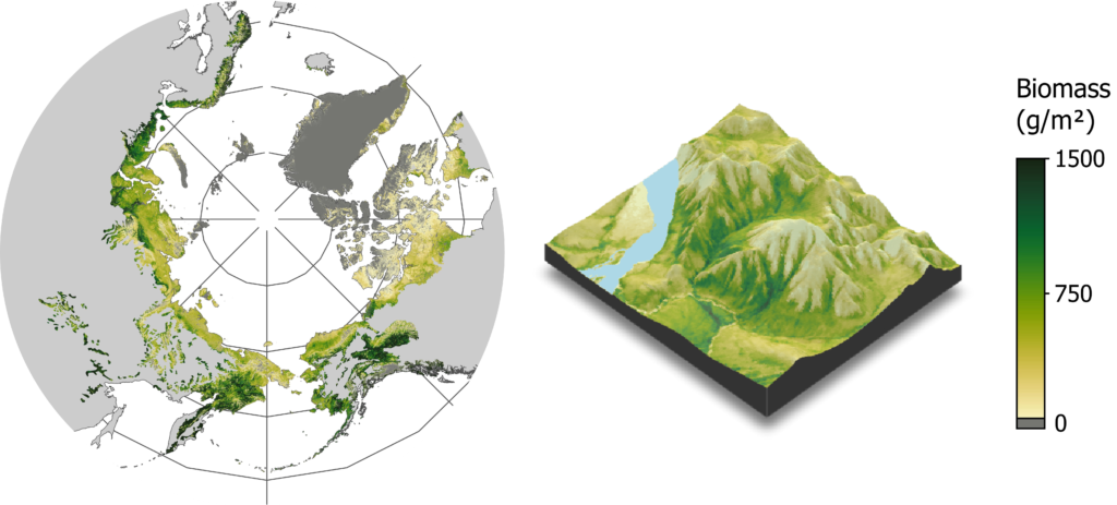
We are developing the first pan-Arctic, moderate resolution (30 m) maps of total and tree/shrub above-ground plant biomass. We are leveraging the Landsat satellite record to create seasonal synthetic composites of spectral features and using these (together with a suite of additional predictors) alongside a new and unique database of plant biomass harvest data to model biomass using machine learning models. Biomass estimates will be paired with pixel-wise uncertainty values to facilitate judicious use of these products. Initial results suggest we are able to distinguish biomass presence vs. absence with high accuracy and quantify biomass with reasonable accuracy. These maps represent the current status of Arctic plant biomass across the biome and can be used for myriad applications related to wildlife, carbon accounting, disturbances, climate modeling and more.
Fate of the Caribou
lead
Elie Gurarie
C0-leads
Scott Goetz, Logan Berner, Mark Hebblewhite (University of Montana), Anne Gunn (CircumArctic Rangifer Monitoring & Assessment Network), Bill Fagan (University of Maryland)
NAU COntributors
Katie Orndahl, Skye Salganek
keywords
Caribou; herbivory; migration; climate change; traditional ecological knowledge; habitat use
Caribou and reindeer (Rangifer tarandus) are perhaps the single most important terrestrial species for both ecological and human systems in the Arctic. With a circumpolar Arctic distribution and high abundance, they play an essential ecological role as herbivores in the slow-growing tundra and as food for predators, scavengers, and humans alike. Their migrations, spanning the northern edges of the boreal forests and the Arctic barrens of the tundra, are the largest terrestrial movements in the world.
The Fate of the Caribou Project is a collaborative research group focused on furthering our understanding of how caribou and the ecosystems and communities that rely on them are affected by climate change and human development. Funded by the National Science Foundation Navigating the New Arctic initiative, we couple cutting edge science and technology with Traditional and Local Ecological Knowledge (TLEK) to inform community-lead stewardship of caribou and to quantify climate-induced changes in caribou distributions to guide land use decision making.
– project summary by Anna Brose
Read more here about the exciting work taking place as part of the Fate of the Caribou project!
Mapping and modeling attributes of an Arctic-Boreal biome shift
lead
Scott Goetz
keywords
Arctic tundra, boreal forest, remote sensing, climate change, modeling, vegetation, mapping, shrub, lichen
This project, part of the Arctic Boreal Vulnerability Experiment (ABoVE), is designed to assess the evidence for vegetation changes and transitions consistent with expectations of a biome shift resulting from changing climate in the high latitudes of North America. Over all three phases of ABoVE, this project has leveraged satellite data, airborne imagery, field measurements and process-based modeling to investigate multiple lines of evidence for the progression of a boreal biome shift, where tree productivity decreases and mortality increases in the southern boreal while suitability for range expansion and densification of woody vegetation (e.g. trees and shrubs) increases in the northern boreal and arctic tundra. Furthermore, we are investigating the implications of such a shift on both flora and fauna, and exploring options for resource management adaptation to change.
This project is part of ABoVE. More information about this project can be found here.
Caribou and vegetation structure in a warming Arctic
nau contributor
Katie Orndahl
Keywords
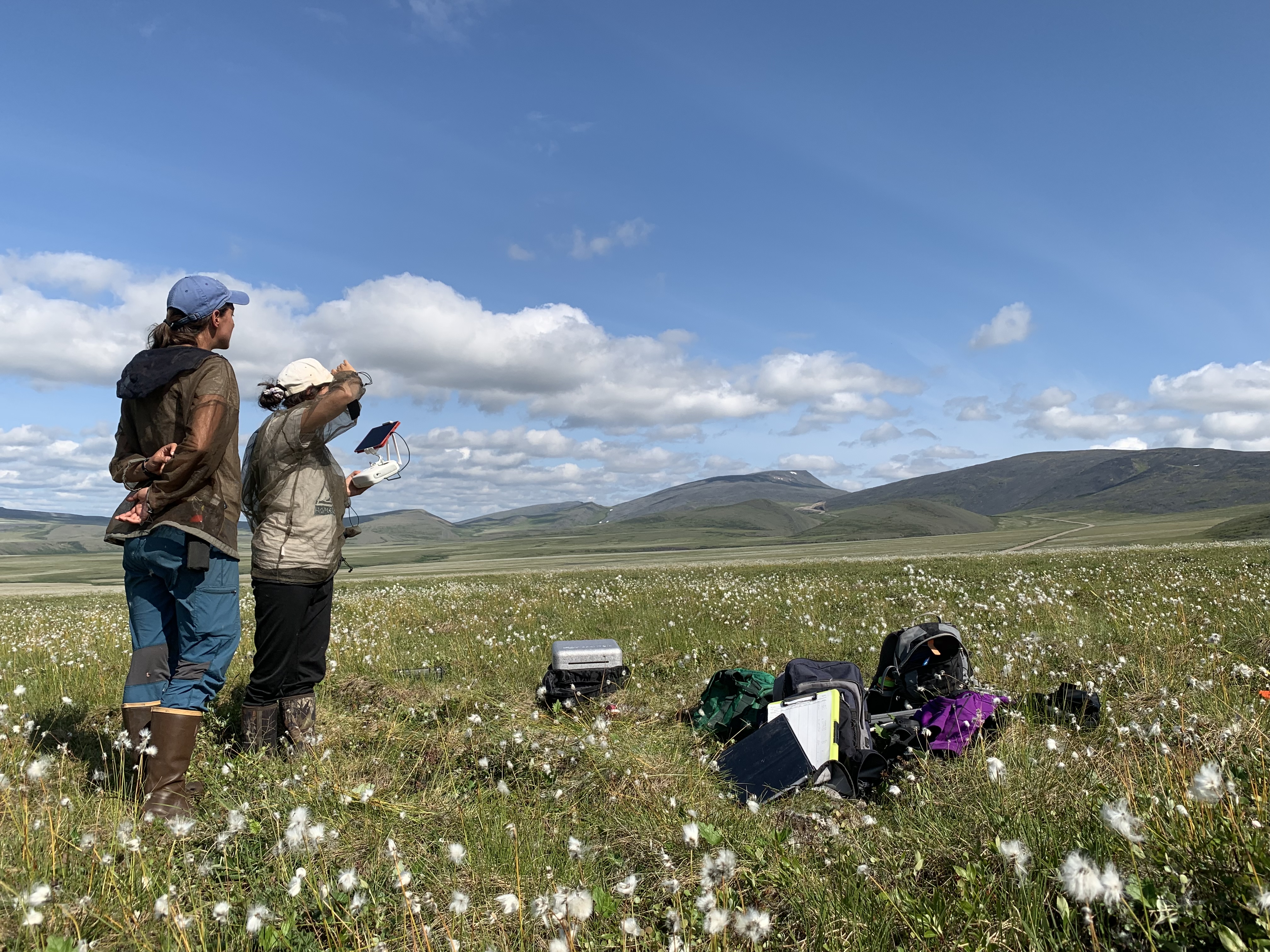
Caribou, unmanned aerial vehicles, biomass mapping, herbivory, carbon cycle, arctic, tundra
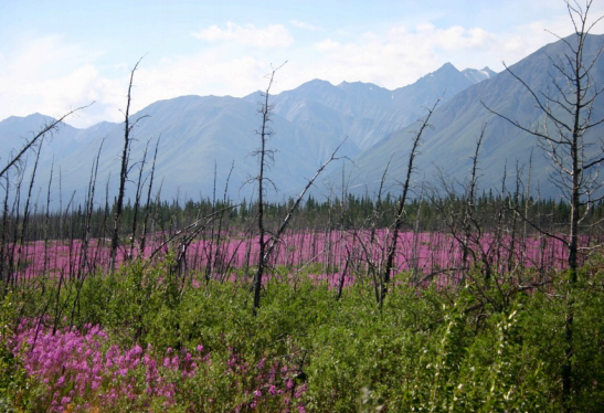
Arctic regions are experiencing some of the fastest rates of climate warming in the world. These regions are poised for significant changes in vegetation composition and structure, which in turn affect carbon cycling. Vegetation and carbon cycle changes have the potential to impact one of the region’s most ecologically, culturally, and economically important species: barren-ground caribou. In addition, caribou have the potential to affect tundra vegetation, creating complicated interactions among herbivore assemblages, climate, and vegetation structure and function. Of particular importance is the potential of caribou to impact ecosystem responses to climate change.
As one of only two large herbivores present in the North American Arctic, caribou play an important role in shaping future Arctic climate and vegetation communities. They will also be acutely affected by changes in climate and vegetation. To understand these interactions, and make accurate predictions about Arctic response to climate change, it is important to both quantify these effects, and explicitly include herbivory in models of Arctic climate and carbon – to “animate” the carbon cycle.
Our work seeks to bridge the gap between small-scale experimental research on arctic herbivore-vegetation interactions, and coarse spatial resolution remote sensing efforts examining these same impacts. We are used a combination of field data, UAV imagery, airborne imagery and satellite imagery to quantify plant functional type biomass at 30 m resolution across barren-ground caribou ranges in Arctic Alaska and Northwest Canada. Products such as these will be used in conjunction with caribou location data to assess caribou-vegetation interactions.