
Earth Dynamics Geodetic Explorer (EDGE)
Lead
Helen Fricker (UCSD)
co-lead
Chris Hakkenberg
Keywords
Satellite swath-mapping lidar, canopy structure, aboveground biomass, surface topography, biodiversity, wildfires, cryosphere
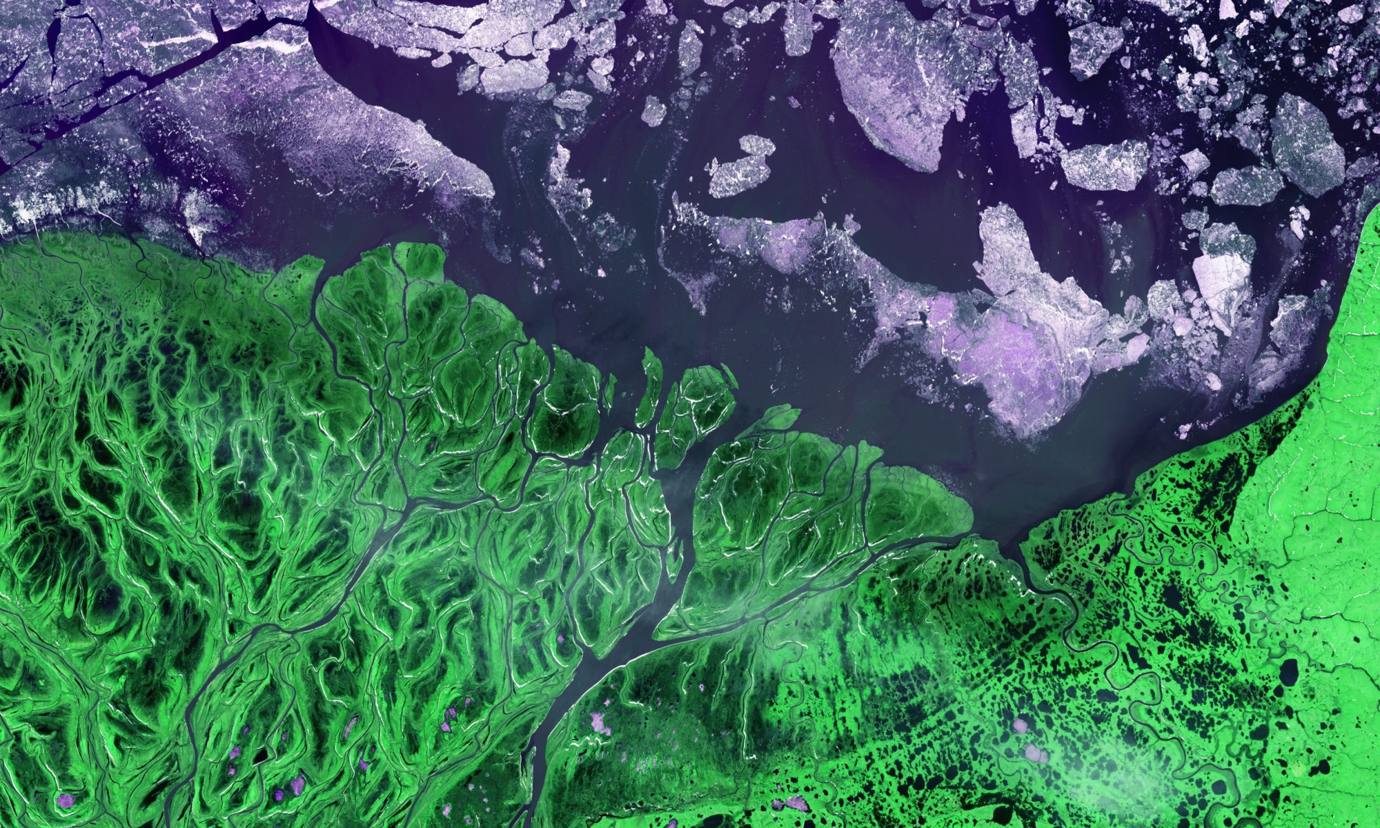
EDGE seeks to understand how the 3D structure of terrestrial ecosystems and the surface topography of glaciers, ice sheets and sea ice are changing in response to climate and human activity. In 2023, EDGE was down-selected among four proposed NASA Earth System Explorers (ESE) Program – which conducts principal investigator-led space science missions as recommended by the National Academies of Sciences, Engineering, and Medicine 2017 Decadal Survey for Earth Science and Applications from Space – for concept studies of missions to help us better understand Earth science key focus areas for the benefit of all including greenhouse gases, the ozone layer, ocean surface currents, and changes in ice and glaciers around the world. The project, which includes GEODE Assistant Research Professor Chris Hakkenberg as Co-I and Biodiversity Co-Lead, will receive $5 million to conduct a one-year concept study. Should the team’s concept be one of two of the four teams selected to advance to the final stage, they will receive a $310 million budget to build the instrument and, with the help of NASA, launch it into space in 2030.

With an increased density of laser beams that will map the planet in five 120-meter-wide strips, EDGE builds on and advances space-borne lidar technology like GEDI and ICESat-2. In comparison, EDGE will provide much higher resolution and accuracy – with vertical accuracy < 1m and contiguous horizontal sampling in 120m swaths with <3m geolocational accuracy – and a much larger extent, ±83 deg latitude. This will provide a more comprehensive view of the dynamics of the Earth’s surface. For Terrestrial Ecosystem Structure, EDGE will (1) quantify how the 3D vegetation structure and aboveground biomass of Earth’s wooded ecosystems has changed in response to natural and anthropogenic disturbances; (2) quantify how 3D vegetation structure and surface topography are related to habitat suitability and biodiversity for the Earth’s wooded ecosystems; (3) quantify woody vegetation carbon fluxes and sequestration potential in response to land use and climate change.

Using GEDI to assess fuel structure, fuel treatments, wildfire severity and post-fire transitions across California wildfires

Lead
Chris Hakkenberg
co-lead
Scott Goetz, Pat Burns, Matt Clark (SSU)
Keywords
lidar, fuel structure, canopy structure, wildfire severity, post-fire landscapes
This multi-project study consists of parts. In the first part, funded from a CALFIRE Forest Health Research grant, investigators will (1) assess whether pre-fire GEDI structural metrics increase the accuracy of forest wildfire severity predictions relative to other commonly-used predictor variables; (2) use GEDI to assess structural change from wildfires as well as from mechanical treatments; (3) interpolate GEDI to create continuous wildfire risk maps across California; and (4) compare predicted wildfire severity among CALFIRE’s Reduce Wildfire Threat to Communities (RWTC) and Reducing Wildfire Risk to Forest Ecosystem Services (RWRFES) priority landscapes. In the second stage, funded with a NASA Global Ecosystem Dynamics Investigation (GEDI) Science Team grant, investigators will derive and validate horizontal landscape maps from GEDI vertical profiles, compare GEDI-derived ‘quantity’ versus optical-derived ‘quality’ of canopy fuels in driving wildfire severity; (3) use GEDI to improve optical-based burn severity maps; and (4) employ multi-temporal continuous GEDI maps of structure to characterize decadal transitions in vegetation structure and pattern for >100ha wildfires across three ecoregions of California (North Coast, Central Coast, and Sierras) between 2006-2009 and 2019-2022.

Quantifying carbon associated with Redwoods Rising

Lead
Chris Hakkenberg
co-lead
Scott Goetz, George Koch (NAU), Phil van Mantgem (USGS), Lucy Kerhoulas (CPH)
Keywords
lidar, redwoods carbon, biomass, canopy structure, forest thinning and management, carbon credits
This three-part study seeks to assess carbon (C) storage and annual C sequestration in Redwood National and State Parks (RNSP), specifically via the Save the Redwood League’s Redwoods Rising restoration activities in Humboldt and Del Norte Counties, CA. Redwoods Rising seeks to implement mechanical thinning in second-growth redwood forests to accelerate the development of old-growth structures. This study will utilize local expertise from the USGS Western Ecological Research Center and Cal Poly Humboldt (CPH) in conjunction with remote sensing mapping and C modeling capacities from NAU. The project combines (1) tree, plot, and stand allometric and biomass relationships; (2) stand development models; (3) air- and space-borne remotely-sensed data; and (4) advanced machine-learning modeling procedures to generate spatially-explicit annual maps of forest C storage and annual sequestration across a range of stand conditions including primary (old-growth) forests, unmanaged secondary (second-growth) forests, and managed secondary forests in the RNSP study area. Outputs from the study will be used to assess the feasibility of a carbon-trading scheme to eventually sustainably fund Redwoods Rising’s operations.
Global Ecosystem Dynamics Investigation
Lead
Ralph Dubayah (UMD)
co-lead
Scott Goetz, Patrick Jantz, Patrick Burns
Keywords
Lidar, canopy height, canopy structure, aboveground biomass, surface topography, international space station, carbon cycle, biodiversity
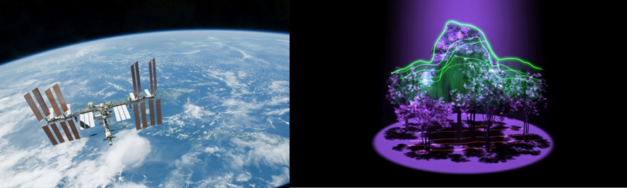
Global Ecosystem Dynamics Investigation (GEDI) is a NASA Earth Venture mission designed to build, launch, and install a lidar (Light Detection and Ranging) instrument on the International Space Station, and derive a suite of forest canopy structure and biomass products. The GEDI lidar will fire billions of laser shots at the surface over the earth over its 2-year operational period (2019-2020) that will allow the science team to map forest canopy heights, canopy three-dimensional structure, aboveground biomass, and surface topography with unprecedented accuracy. GEDI data products will be useful for a range of science applications with societal benefits, including informing models of carbon and water cycling processes, biodiversity and habitat mapping, weather forecasting, forest management, glacier and snowpack monitoring, and more accurate elevation models of the earth’s surface.
This short video gives an excellent overview of the GEDI mission:
For more details, see the full story here.
More information about GEDI can also be found here or by clicking the project title, above.
How will forest ecosystems and hydrologic processes in the Delaware River Basin be affected by climate change and land cover change?
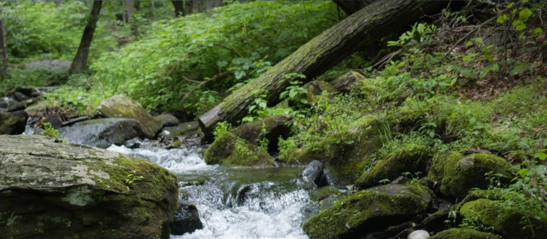
Photo by Keith Survell. 2017. “Pond Run Creek.” Shared on flickr (CC BY-NC-SA 2.0). Last accessed on July 17, 2017.
lead
Claire Jantz (Shippensburg University)
co-lead
Patrick Jantz
Keywords
Land use, land cover, climate change, hydrology, forest ecosystems, watersheds, Delaware River Basin
Our purpose is to explore how the multiple stressors of climate change and land use/land cover (LULC) change will alter hydrologic systems and forest ecosystems in the Delaware River Basin (DRB). To accomplish this purpose, our goal is to construct a basin-wide coupled modeling framework that builds on four existing models: a land use/land cover change model under development with funding from the William Penn Foundation (WPF) (C.A. Jantz et al. 2015), a gridded basin-wide hydrologic water budget model (Hawkins 2015), the HEC-HMS rainfall-runoff model, and a suite of distribution models for 40 eastern U.S. tree species (P.A. Jantz et al. in press). As a basin-wide study, this research will generate consistent, high-resolution, gridded data sets, thus providing improved understanding of the regional manifestations of climate and land use changes, a critical starting point for any coordinated adaptive management effort. For more information, see the Delaware River Basin website.
This project is supported through the Delaware Watershed Research Fund (DWRF), a new opportunity for research funding intended to complement the broader watershed protection work of the William Penn Foundation. The DWRF will build on the goals of the Delaware River Watershed Initiative (DRWI) to ensure water quality in the Delaware Basin through restoration, protection, and monitoring of watersheds.
Soundscapes to Landscapes in Sonoma County, CA
![]()
lead
Matthew Clark (Sonoma State University)
co-lead
Patrick Burns, Scott Goetz
keywords
Soundscapes, citizen science, bioacoustics, biodiversity, species richness, lidar, GEDI
Remote sensing plays a critical role in long-term monitoring of biodiversity across spatial and temporal scales. This research has the broad goal of advancing scientific understanding of biodiversity and conservation using a combination of new and existing spaceborne sensors. The main objectives are to:
- Involve citizen scientists in the collection of in situ field information for earth observation of biodiversity
- Assess the accuracy and precision of bioacoustics for the detection and monitoring of individual species and richness
- Test the predictive strength of spaceborne imaging spectroscopy, lidar, synthetic aperture radar sensors for spatial modeling of species occupancy and overall species richness and
- Use occupancy/richness maps to better understand factors related to conserving animal diversity.
We focus our investigation in Sonoma County of northern California, an area with a diverse range of natural vegetation, urban and agricultural gradients.
To demonstrate the potential of space-borne imaging spectroscopy and lidar to biodiversity monitoring, the science team will simulate Hyperspectral Infrared Imager (HyspIRI) and Global Ecosystem Dynamics Investigation (GEDI) large- footprint lidar data at the county scale. Metrics derived from these simulated data will provide unique, wall-to-wall information on vegetation chemistry and three-dimensional structure that will be linked with in situ citizen science data to model species occupancy and overall richness at the landscape scale.
To learn more visit Soundscapes to Landscapes or view our project abstract here.