GEODE lead Scott Goetz was recently named Regents’ professor by NAU president Rita Cheng. Regents’ professors must have outstanding achievements and be distinguished nationally and internationally in their fields. Goetz is recognized for his long career of impactful research using satellite remote sensing research to study the effects of a changing climate. Goetz is the science lead of NASA’s Arctic Boreal Vulnerability Experiment and deputy PI of NASA’s Global Ecosystem Dynamics Investigation. Through these roles and beyond, he continues to contribute to our global understanding of how climate change is restructuring ecosystems. Congratulations, Scott!
Dr. Logan Berner was named a 2021Champion of the Environment by the ARCS Foundation. Berner is an Assistant Research Professor in the GEODE lab and a former ARCS Scholar who’s research focuses on how terrestrial ecosystem are impact by climate change. The ARCS Foundation is a national nonprofit organization founded and run entirely by women with the goal advancing American leadership, science, and technology. Berner and several other former ARCS Scholars were recognized for leading the way in preserving and protecting Planet Earth. Read more at https://www.arcsfoundation.org/earth-day-2021.
GEODE Lab lead Scott Goetz was recognized as one the most highly cited researchers in the world based on a new “composite indicator” approach to publication impact. The top 100,000 scientists from all fields of science were identified following analysis of some 7 million scientists worldwide, as reported in the journal PlosONE Biology. Goetz and 28 other NAU current or retired professors were included in the list based on their career long impact
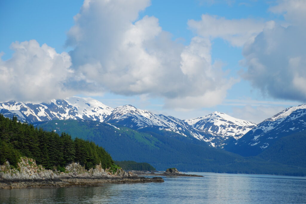
The Tongass National Forest helps protect Earth’s climate and provides crucial refuge for myriad plant and animal species, including five species of salmon. Photo credit: Logan Berner
The Tongass National Forest stretches across Southeast Alaska to form not only the largest National Forest in the United States, but also the largest remaining coastal temperate rainforest in the world. This coastal temperate rainforest helps protect Earth’s climate by taking up and storing large amounts of carbon, while also providing habitat for many plant and animal species including five species of salmon. The 2001 Roadless Rule provided protection for this unique and important ecosystem, at least until Fall 2020 when the United States Department of Agriculture revoked protection in an effort to increase logging and mining. A new article by PBS NOVA describes how, “Opening up the Tongass National Forest to additional logging and development could have serious implications for both the environment and the Alaska Native communities that depend on it.”
PBS NOVA interviewed GEODE lab member Logan Berner for this story. Logan was born and raised in the Tongass National Forest and is now an Assistant Research Professor of Global Change Ecology in the School of Informatics, Computing, and Cyber Systems at NAU.
“We’ve already seen wild salmon populations decline in much of western North America because of watershed deterioration, and exempting the relatively pristine Tongass National Forest from the roadless rule would adversely affect fisheries as well as recreation and tourism, which are huge elements of the economy in Southeast Alaska,” Berner says. Increased logging would also release additional carbon into the atmosphere, thereby contributing to the global climate crisis.
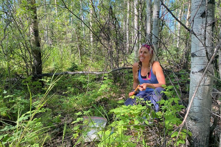
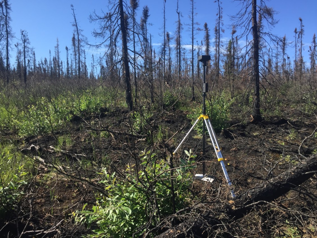
Xanthe Walker collects field data in the boreal forest Photo credit: NAU News
As the climate warms, boreal forests are experiencing more frequent and more severe wildfires. These burning forests release carbon to the atmosphere which exacerbates climate warming and underscores the urgency of understanding boreal forest fire dynamics.
Boreal forests are unique in that they store large amounts of carbon in the soil — this underground carbon might be the key to understanding carbon emissions from wildfires.
New research published in Nature Climate Change finds the amount of carbon stored in soils is the biggest predictor of how much carbon burns in boreal wildfires.
This work was lead by Xanthe Walker of NAU’s Center for Ecosystem Science and Society (Ecoss) with Michelle Mack (Ecoss) and GEODE lead Scott Goetz contributing as co-authors.
Walker and her team collected data from 417 burn sites across Alaska and Canada and found that fuels (i.e. combustible material) not fire weather were the major factor determining how much carbon is released when forests burn.
Although they may seem monotonous to the untrained eye, boreal forests are a complex mosaic with differing ecosystem structure, forest age, species composition, topography, soil moisture, and permafrost conditions.
These diverse conditions will be key to predicting how much carbon will be released from future wildfires. For example, black spruce is highly flammable and therefore stands with a large proportion of black spruce are likely to release large amounts of carbon to the atmosphere when they burn.
Walker’s research suggests that researchers and managers should shift some focus from fire weather (historically the focus of fire models) to fuels (understanding the distribution of vegetation and organic soils across the landscape).
“The Arctic tundra is one of the coldest biomes on Earth, and it’s also one of the most rapidly warming … “
” … This Arctic greening we see is really a bellwether of global climatic change – it’s a biome-scale response to rising air temperatures.”
Logan Berner, GEODE lab
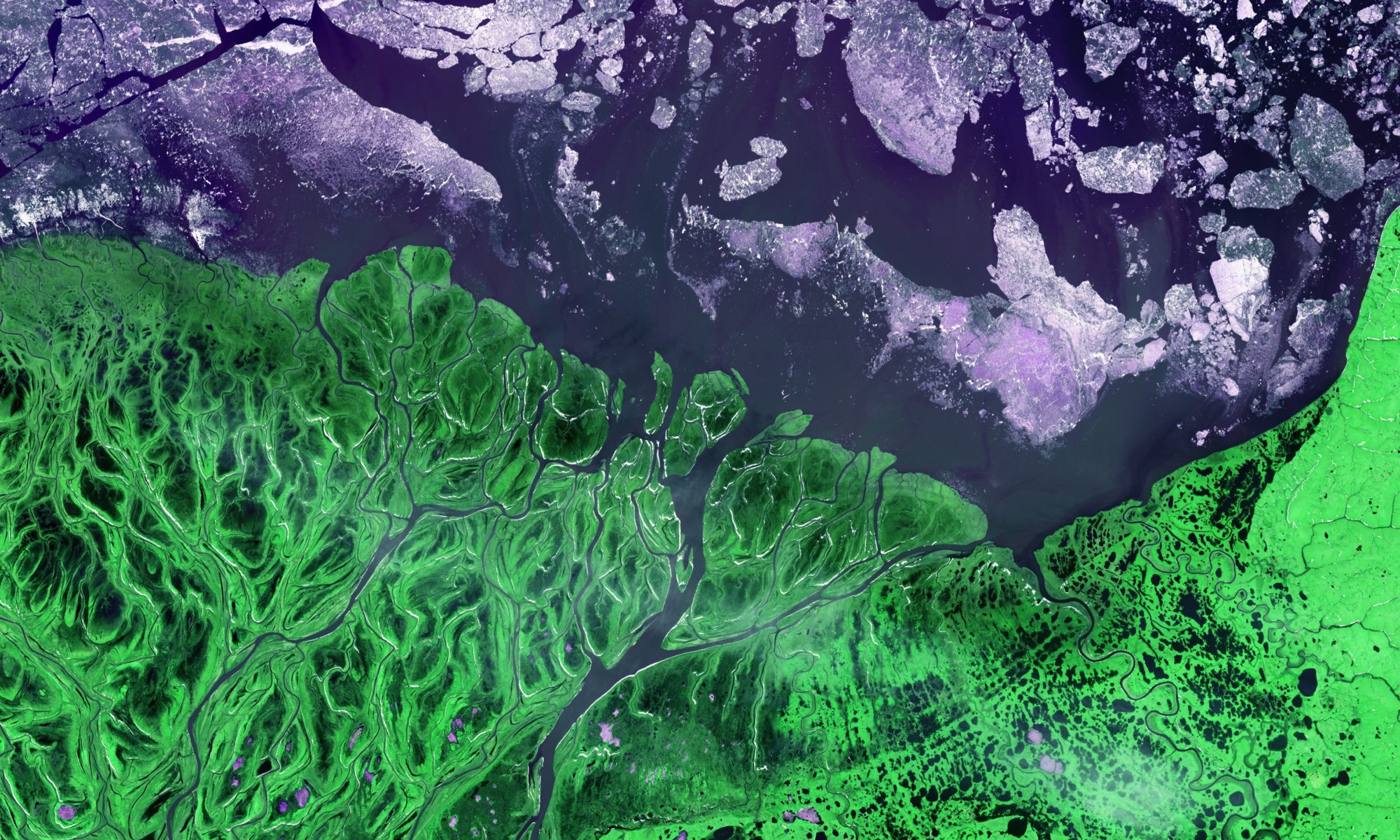
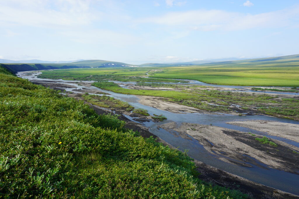
The GEODE lab led a new study published in Nature Communications that shows much of the Arctic tundra biome became greener during recent decades, likely due to rising summer air temperatures stimulating plant growth.
Landsat satellite observations from 1985 to 2016 revealed widespread increases in tundra greenness across North America and Eurasia.
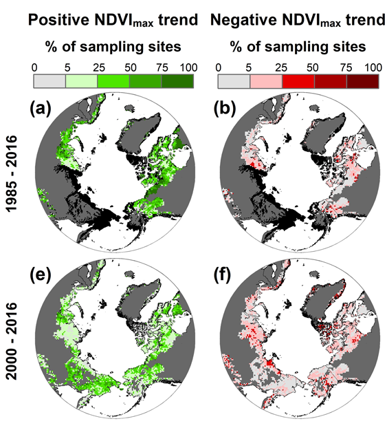
Percentage of sites experiencing greening (left, in green) and browning (right, in red) across two time periods: 1985-2016 and 2000-2016. Grey indicates areas not considered part of the Arctic, black indicates areas where Landsat imagery was not available for the time period.
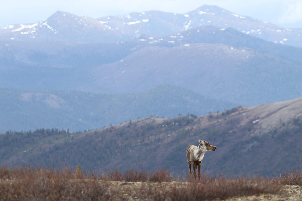
Tundra greenness tended to increase in areas that warmed. On the ground, this increase in greenness translates to plants colonizing previously barren areas, as well as existing plant communities growing taller, leafier, and often shrubbier. These changes can impact wildlife habitat and how people in northern communities use local ecosystems, as well as feedback on climate by impacting carbon cycling and surface energy balance.
Changes in Arctic greenness can impact wildlife species, including reindeer and caribou. Photo Credit: Libby Ehlers
This study is the first to evaluate pan-Arctic changes in tundra greenness using the Landsat satellites, which have much finer spatial resolution than satellite measurements used in prior assessments.
The study was led by Assistant Research Professor Logan Berner and is part of a larger project run by Professor Scott Goetz that is supported by NASA’s Arctic Boreal Vulnerability Experiment (ABoVE). The study also included Patrick Jantz (Assistant Research Professor), Richard Massey (Postdoctoral Researcher), and Pat Burns (Research Specialist) from the GEODE lab, as well as field ecologists at eight institutions around the world.
Learn more about Logan’s research with this short video from NASA:
Or, head straight to the science and read the full paper.
Check out additional coverage of this work from NASA and NAU News.
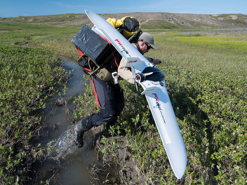
Drones are an important addition to scientists’ toolkits for measuring global change, concludes new study in Environmental Research Letters
In between flights, researchers backpack with their equipment plus drone over the spongy tundra of Qikiqtaruk. Credit: Jeff Kerby
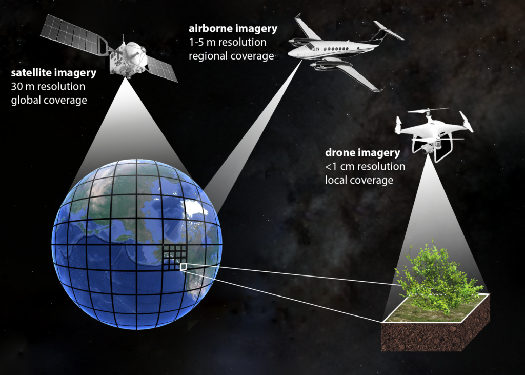
A scientist’s toolkit for understanding Arctic vegetation change (primarily driven by Arctic “greening”) has often relied on two main tools: field work and satellite imagery.
Field work is highly detailed – researchers meticulously estimate vegetation cover, measure height, and weigh plants to determine their mass. Scientists come away with detailed and accurate data, but it comes at a price. This work is tedious and time consuming. And, in an area as remote as the Arctic, simply getting to field sites is costly, often involving lengthy flights or grueling hikes across challenging terrain.
This work is extremely important because of the level of detail it contains – this data is as close to “true” as we can get. However, the scope is small. Field plots are often about the size of a coffee table. Consider the vastness of the Arctic and you can see why a few coffee tables scattered across the tundra do not capture the full picture.
At the other extreme is satellite imagery. Using images beamed back to Earth from satellites that orbit constantly, scientists can look at pictures anywhere in the Arctic dating back to the 1980s. This tool provides excellent coverage, but it comes at the price of detail. Pixels from satellite imagery “are maybe the size of Manhattan,” says Jeff Kerby, ecologist at Aarhus University in Denmark. These pixels can tell scientists which areas have gotten greener (or browner), but cannot provide much detail about the mechanisms that cause the greening.
It is a big leap from detailed data the size of a coffee table, to a single “greenness” value representing an area the size of Manhattan. “You end up with that gap in between,” said Andrew Cunliffe, research fellow at the University of Exeter in the United Kingdom. In a new study in Environmental Research Letters, Cunliffe and his colleagues suggest drones might be the key to bridging this gap in scale and scope.
Drones are relatively portable and inexpensive. Scientists can bring them to the field with them and collect imagery as they conduct field work. The result is an expanded view of the field site, the size of several football fields as opposed to a single coffee table. And the resolution is impressive too – scientists can obtain imagery with pixels as small as a single centimeter. This makes drones an important ‘middle man’ between field work and satellite imagery. Scientists can use drone imagery to peer inside a single satellite imagery pixel for more detail.
What’s more, new technology allows researchers to stitch together images from drone flights to create 3D reconstructions of sites. This adds a third dimension of information, not usually afforded by satellite imagery. These structural metrics, along with measures of greenness provide “an unprecedented opportunity to monitor changes both in tundra greenness and canopy structure such as canopy height and aboveground biomass,” according to Alemu Gonsamo, a remote sensing vegetation and climate change scientist at McMaster University in Canada.
GEODE lab members are also excited about drone potential. We in the GEODE lab know that “Scale is one of the key issues with remote sensing,” as summed up nicely by GEODE lead Scott Goetz.
“There is tremendous potential for the sort of work that they have done to improve our understanding for what these changes in tundra greenness mean, why they’re happening, and how the Arctic might change in the future,” adds GEODE assistant research professor Logan Berner.
Read more about how Arctic researchers are using drone technology, or head straight to the science.
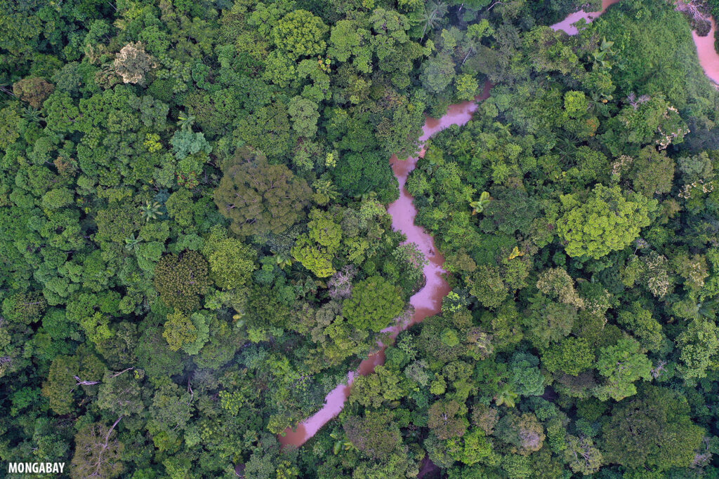
Bird’s eye view of a tropical forest in the Colombian Amazon. Photo by Rhett A. Butler for Mongabay.
Not all tropical forests are created equal.
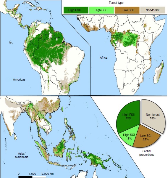
According to new research published in Nature Ecology & Evolution, “tropical forests vary in composition, structure and function such that not all forests have similar ecological value.”
The problem is, international forest conservation strategies often focus exclusively on forest extent and fail to consider forest quality. These policies mandate the preservation and restoration of forests, but do not distinguish between highly degraded, low quality forests, and fully intact forests with high structural and ecological integrity. This means many high quality forests are slipping through the cracks — most have no formal protection and are thus at great risk of being lost.
To pull these forests from obscurity, the study authors, including GEODE lab members Pat Burns, Patrick Jantz, and Scott Goetz, created high resolution maps of areas of high forest integrity. In this case, integrity is determined by forest structure (high quality forests have tall, multistory canopies and a large diversity of plant sizes) and human impact (high quality forests have experienced minimal human development).
New maps show the distribution of high integrity forests (“High FSII”) across the globe — most of these high quality forests are concentrated in the Amazon and Congo basins.
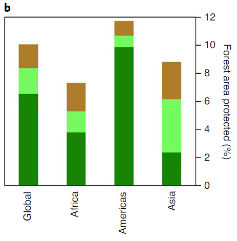
Now that we have an idea of where these forests are and how few of them are protected (only 6.5 percent!) we can begin to craft effective policies that take forest integrity into account.
Only 10% of the world’s tropical forests are formally protected, and only 6.5% of the world’s high quality tropical forests
In order to protect these ‘best of the last’ forests, the authors propose a policy-driven framework for conservation and restoration, that focuses on preserving and restoring forest integrity.
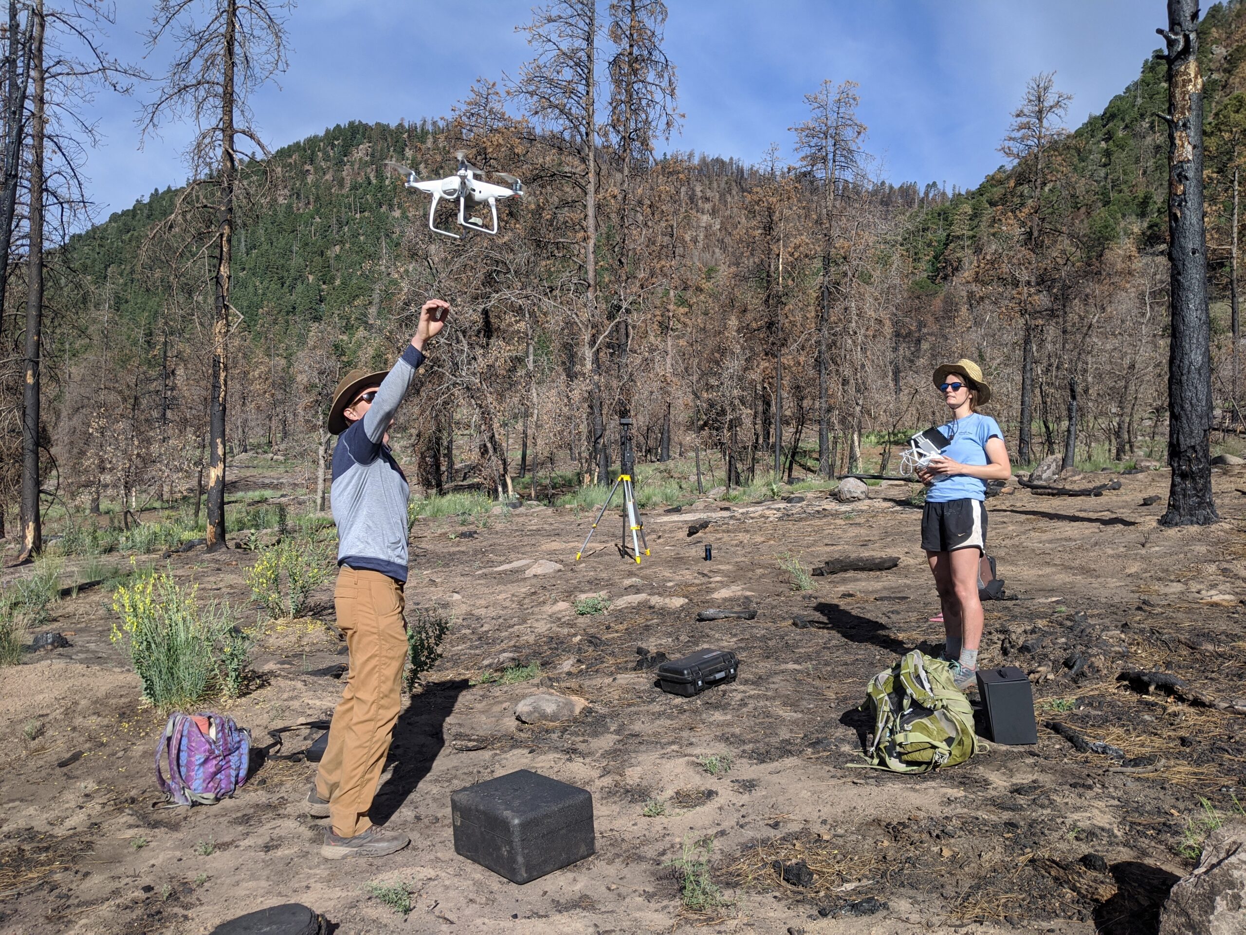
The GEODE lab is ready to fly. Our group has invested in an arsenal of unmanned aerial vehicles (UAVs) and accessories to enhance the lab’s research.
Pat and Laura test out the Phantom 4 Multispectral at the Museum Fire, just outside of Flagstaff, AZ
UAV imagery is a natural “bridge” between fine scale field measurements and coarse scale (but spatially expansive) satellite remote sensing.
Credit: Katie Orndahl
Coming in a variety of shapes and sizes, wings and rotors, UAVs can provide extremely detailed 2D aerial views, with resolution down to sub-centimeter pixels.
The lab’s fleet includes:
DJI Mavic Pro 2: portable and nimble with 20 megapixel RGB camera, perfect for reconnaissance and capturing breathtaking 1080p video
DJI Phantom 4 Multispectral: a new offering from DJI that has an integrated multispectral camera with 2 megapixel red, green, blue, red edge and near infrared (NIR) bands, all on global shutters and a stabilizing gimbal. The NIR and red edge bands are critical for vegetation mapping and having a multispectral sensor fully integrated into the drone should ease some headaches in data processing. This drone also features RTK technology which, along with a GNSS receiver, allows for centimeter level accuracy in geolocation.
senseFly eBee X fixed wing drone with a collection of accessories including:
RTK capability
Endurance capability, which allows for flight times up to 90 minutes
SODA 3D camera which captures 2 oblique and 1 nadir at each time stamp to allow for better 3D site reconstructions
Micasense RedEdge MX multispectral sensor with 1.2 megapixel red, green, blue, red edge and near infrared (NIR) bands, all on global shutters
Emlid Reach RS2 GNSS receiver for utilizing drone RTK capabilities
After flight, Structure from Motion technology allows users to transform simple RGB imagery from UAV flights into dense 3D point cloud reconstructions.
Fly-through of a 3D point cloud reconstruction created using Structure from Motion. UAV imagery was captured at a site within the Museum Fire burned area near Flagstaff, AZ
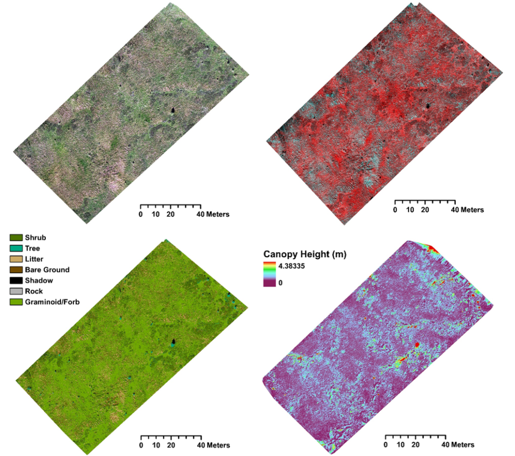
GEODE PhD student Katie Orndahl is already leveraging UAV technology in her work. Orndahl uses a Phantom 4 quadcopter UAV with attached multispectral sensor to survey sites across the Alaskan and Canadian Arctic. She is exploring the feasibility of UAVs for estimating above-ground biomass of tundra ecosystem plant functional types. Ultimately, Orndahl will be using UAV imagery and products as intermediate steps towards producing Landsat based plant functional type above-ground biomass estimates, which will be used to assess caribou habitat and quantify the extent to which caribou density impacts vegetation community composition and structure.
UAV derived products, clockwise from top left: orthomosaic (RGB), orthomosaic (CIR), canopy height, vegetation classification. Credit: Katie Orndahl
Laura Puckett, a new addition to the GEODE lab, is using UAVs in her PhD work to map above and belowground combustion in boreal forest wildfires. Combustion of deep organic soils from these fires is a large source of carbon to the atmosphere. Dramatic sub-meter heterogeneity in burn severity makes it impractical to relate field measurements to coarse-scale remotely sensed datasets. Laura is exploring the use of UAV imagery as a stepping stone for scaling field measurements to 20m Sentinel-2 pixels for large scale mapping.
GNSS receiver hard at work communicating with an airborne drone amongst charred black spruce near Fairbanks, AK
Drone technology will be an invaluable resource for the GEODE lab, and members are already scheming up new ideas for integrating UAVs into the lab’s research.
Check out our new research page on to stay updated on UAV based research coming out of the GEODE lab!
GEO and Google Earth Engine announced support for 32 projects to enhance sustainable outcomes for Earth’s ecosystems. One of those projects, the Ecological Integrity Index, was developed by Ivan Gonzalez, a Ph.D. student in the GEODE lab.
“We are thrilled to be among the selected projects and to be able to develop our idea with the support of the GEO-Google Earth Engine Programme.”– Ivan Gonzalez
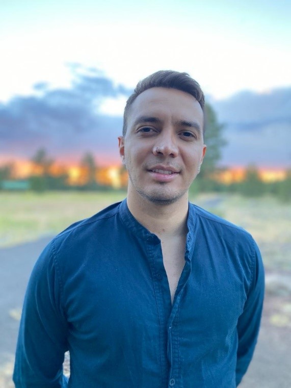
Ivan Gonzalez, Flagstaff, Arizona
The award includes a commercial grade Google Earth Engine license, technical support, and mentoring provided by EO Data Science. Read the official announcement here.
Mapping Ecological Integrity
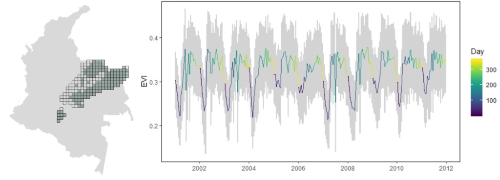
The Ecological Integrity Index aims to use Earth observations to describe temporal and spatial dynamics in each ecosystem in Colombia, identifying natural trends and likely perturbations due to human activities. The Index leverages the power of Google Earth Engine’s global observation and computing platform to evaluate ecosystem changes anywhere in Colombia in the context of historical trends.
Expected annual natural vegetation trends (EVI) for the Los Llanos ecosystem in Colombia measured by the Moderate Resolution Imaging Spectroradiometer (MODIS). The line color represents day number from 1 to 365. Spatial variability is shown in gray.
Ivan will work closely with collaborators in Colombia to ensure the Ecological Integrity Index benefits decision makers working on the ground. Ivan, as a native of Bogotá, Colombia, has first-hand experience with land-use and water management challenges in the megadiverse country.
“This opportunity will allow us to test the index and cooperate with the Humboldt Institute, National Parks office, Conservation International, and The Nature Conservancy in Colombia which are seeking solutions to environmental challenges related to sustainable land and water use in a changing climate.“ – Ivan Gonzalez
The project team consists of Ivan Gonzalez (NAU-SICCS), Scott Goetz (NAU-SICCS), and Patrick Jantz (NAU-SICCS) with collaborators Andrew Hansen (Montana State University), María Cecilia Londoño Murcia (Insituto Alexander von Humboldt), Natalia Acero (Conservation International), Juan Carlos Clavijo Flórez (National Natural Parks), and Jorge Velásquez-Tibatá (The Nature Conservancy).
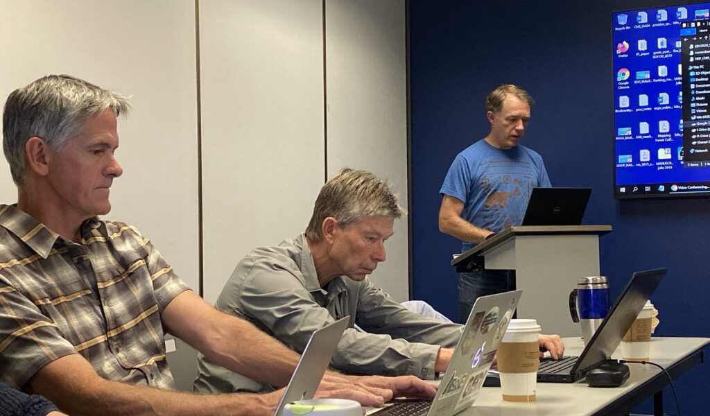
Team members (from left to right) Scott Goetz, Andrew Hansen, and Patrick Jantz at a project meeting at Northern Arizona University, Flagstaff, Arizona.